Essential Costa Rica

Visit Costa Rica

  • Home
  • Costa Rica

    About Costa Rica

    • About Costa Rica
    • Knowing Costa Rica
    • What makes Costa Rica Unique?
    • Sustainability

    About CR 2

    • National Parks
    • Climate
    • FAQ's

    Information

    • Bus Itinerary
    • Costa Rica Blog
    • Find some Balance
  • Things To Do

    Things to Do 1

    • Adventure
    • Sun and Beaches
    • Ecotourism

    Things to do 2

    • Culture
    • Families
    • Rural Tourism

    Things to do 3

    • Birdwatching
    • Honeymoon and Weddings
    • Wellness

    Things to do 4

    • Cruises
    • Meetings and Incentives
    • Greatest Wildlife Spectacles
  • Where to Go

    col 1

    • Guanacaste
    • Caribbean

    col 2

    • Puntarenas
    • Central Valley

    Col Mapa

    • Northern Plains
    • Central Pacific

    Col 3 where

    • South Pacific
    • Costa Rica Maps
  • Planning your trip

    Touristic Service Providers

    • Suggested itineraries
    • Accommodations
    • Airlines Flying to Costa Rica
    • Rent A Cars in Costa Rica

    Travel Information

    • Exchange Rates
    • Entry Requirements
    • Traveler Tips
    • Tourism Information Centers

    Agencias

    • Bus Itinerary
    • Restaurants
    • Local Travel Agencies

    Service Providers 2

    • International Travel Agencies
    • Other Activities
    • Tour Guides
  • More

    Contact Us

    • Contact Us
    • Phone Numbers
    • Press

    Follow Us 2

    • Email Sign-Up
    • Complaint
    • Publications
    • Instagram

    Follow Us

    • Pinterest
    • Facebook
    • Twitter
    • YouTube

Visit Costa Rica

  • English
  • Español
  • Français
  • Deutsch
  • Italiano
  • Portuguese

Search form

  • Home
  • Costa Rica

    About Costa Rica

    • About Costa Rica
    • Knowing Costa Rica
    • What makes Costa Rica Unique?
    • Sustainability

    About CR 2

    • National Parks
    • Climate
    • FAQ's

    Information

    • Bus Itinerary
    • Costa Rica Blog
    • Find some Balance
  • Things To Do

    Things to Do 1

    • Adventure
    • Sun and Beaches
    • Ecotourism

    Things to do 2

    • Culture
    • Families
    • Rural Tourism

    Things to do 3

    • Birdwatching
    • Honeymoon and Weddings
    • Wellness

    Things to do 4

    • Cruises
    • Meetings and Incentives
    • Greatest Wildlife Spectacles
  • Where to Go

    col 1

    • Guanacaste
    • Caribbean

    col 2

    • Puntarenas
    • Central Valley

    Col Mapa

    • Northern Plains
    • Central Pacific

    Col 3 where

    • South Pacific
    • Costa Rica Maps
  • Planning your trip

    Touristic Service Providers

    • Suggested itineraries
    • Accommodations
    • Airlines Flying to Costa Rica
    • Rent A Cars in Costa Rica

    Travel Information

    • Exchange Rates
    • Entry Requirements
    • Traveler Tips
    • Tourism Information Centers

    Agencias

    • Bus Itinerary
    • Restaurants
    • Local Travel Agencies

    Service Providers 2

    • International Travel Agencies
    • Other Activities
    • Tour Guides
  • More

    Contact Us

    • Contact Us
    • Phone Numbers
    • Press

    Follow Us 2

    • Email Sign-Up
    • Complaint
    • Publications
    • Instagram

    Follow Us

    • Pinterest
    • Facebook
    • Twitter
    • YouTube
Rincón de
La Vieja Volcano
National Park

You are here

Home » Costa Rica » Where to Go » Protected areas » Rincón de La Vieja Volcano National Park
Rincón de La Vieja Volcano National Park

This national park is where the Rincon de la Vieja Volcano is located. There are two 31,000 acre areas: Las Pilas and Santa Maria. There are nine cones all together and a lagoon called “Los Jilgueros.”

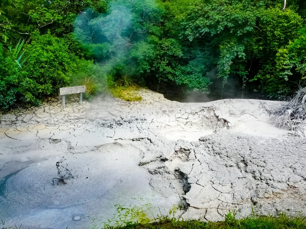
Pailas Area: trails (4 miles long) to the Von Seebach craters (6,200 ft. above sea level); Rincon de la Vieja (6,000 ft. above sea level) trail to Las Pailas (1.5 miles); trail to the La Cangreja Waterfalls (3 miles) and Escondidas (2 miles); trail to Blanco River well (2,000 ft.); trail to the fumaroles and mud pits.

Santa Maria area: trail to the Encantado (Enchanted) Forest waterfall (3500 ft.); trail to Pailas area (4.5 miles); trail to Las Pailas de Agua Fria (5,200 ft.); trail to hot springs (1.5 miles). Around the administration area there are restroom services and picnic areas, as well as a camping area. There is also a historical house and a mill. The park can be accessed on the Buenos Aires de Upala side.

Surface Area: 
14,127
Hours of Operation: 
Tuesday to Sunday from 7 a.m. to 3 p.m. (Pailas Sector) and daily from 8 a.m. to 4 p.m. (Santa María Sector)
Telephone: 
+506 2666-5051
Directions: 

Las Pailas Sector: From San José, drive north towards Puntarenas and then follow the Inter-American Highway towards Liberia. Once in Liberia, continue 5 km north on the Inter-American North Highway to the entrance to Curubandé and RVNP, drive about 15 km northeast on a paved road through the village of Curubandé, where you will reach a metal gate; continue past this gate for approximately 10 km on a gravel road to reach Las Pailas Sector.

Santa María Sector: From San José take the Inter-American Highway towards Liberia. Take the road that starts at Barrio La Victoria, and then take the road leading to the village of Colonia Blanca, then turn left for approximately 25 km.

Universal Path: 
No
Detail: 
There are about 700 m. of path in concrete that is accessible; but it is not categorized as a universal path.

Planning your Trip to Costa Rica

Suggested itineraries

Accommodations

Rent A Car

Airlines

Restaurants

Other Activities

Local Travel Agencies

Travel Tips

  • Home
  • Costa Rica
  • Costa Rica Blog
  • Things To Do
  • Where to Go
  • Planning your trip
  • National Parks
  • Climate
  • FAQ's
  • Contact Us


Costa Rica Tourism Board, Institutional Site

Costa Rica Convention Center, Promotional Site


© Costa Rica Tourism Board | Terms of Use | Privacy Policy | Site Map

Logo