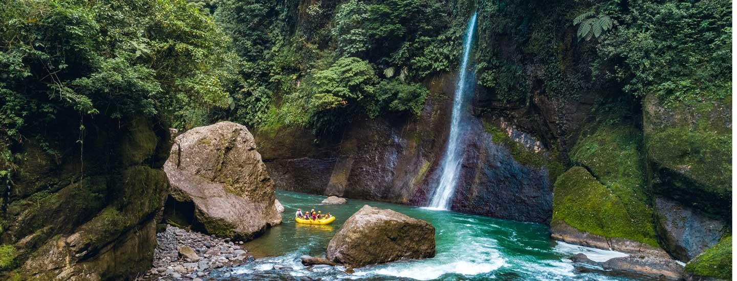
Enjoy 16 km of trails

Cartago is a province with plenty to offer tourists: visits to volcanoes, taking in its lookouts and seeing the spots where important historical events took place. The Prusia Forest is the perfect weekend escape for families, couples or friends. So lace up your sneakers, put on comfortable clothing and come experience the nature that surrounds us.

The tour is self-guided, offering the opportunity to take your time and enjoy the experience at your own pace. The path going around the forest is about 16 km in length, the most trails of any park in the Greater Metropolitan Area (GAM).

Please note that you will need to keep an eye out for arrows and the color signs that indicate the trails on which you will need to travel.

A bench sitting in the middle of a forest.

Visit the bewitched tree

One of the forest’s attractions is the famous “bewitched tree”. The forest rangers tell us that the name is due to a visitor who hung the figure of a witch from the tree, a custom that was followed by others, who placed other objects on the tree. The custom is no longer practiced, however, and the tree is now totally unadorned. However, the tree’s shape gives it a mystical appearance.

You can see the tree for yourself by taking the El Roble trail, continuing along the El Puma trail and then the Los Abuelos trail. Be sure to take a picture of the trail map at the park entrance, which will allow you to follow along during your hike.

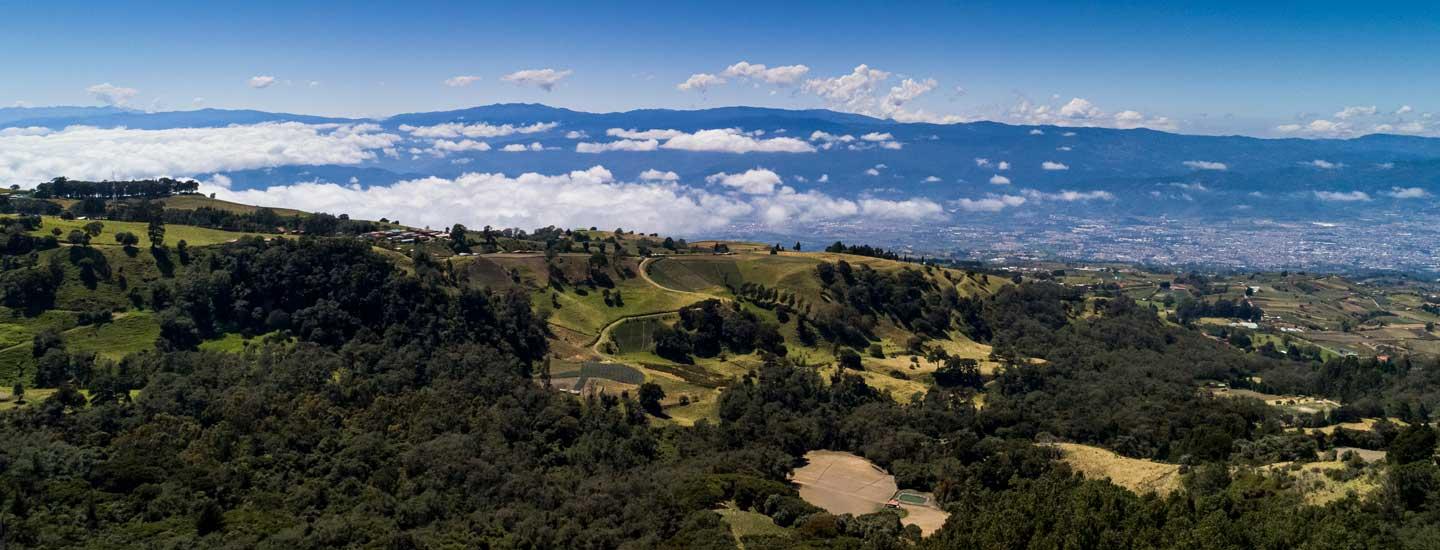
The forest is also home to other attractions, including Cerro Retes, one of the highest points in the area, where you can observe the slopes of the Irazú Volcano. Cerro Cabeza de Vaca is another local peak, with views of the Barva Volcano. The Laguna del Reventado is another local attraction.

A view of the top of a mountain with clouds below.

Keep your eyes and ears open on your hike and you just might come across local fauna, including birds, gray foxes, coatis, tayras, porcupines, and more. You’ll also become ensconced in the vegetation of dense stands of eucalyptus, pines and other tree species.

Note, however, that the popular mountain of yellow flowers you may have seen in photos is actually not in the forest. If you want to visit that mountain, you’ll need to take the road towards the Irazú Volcano, about 1 km beyond the entrance to the Durán Sanatorium. Remember that the area is private property, so you must ask permission before entering.

Ready for adventure?

Everything you need to know:

  • Hours of operation: 8:00 a.m. to 4:00 p.m.
  • Last entrance to the forest: 3:00 p.m.
  • Price for citizens: ₡1,000.
  • Price for children: ₡500.
  • Price for foreign nationals: $5.
  • Seniors enter free of charge.
  • Payment can be made with card or cash.
  • Parking free on weekdays.
  • ₡1,000 (cash) donation to the Red Cross on weekends.
  • A meeting room and auditorium are available.
  • The location includes drinking water, restrooms and a picnic area.
  • School groups can enter free of charge by prior arrangement; please call.
  • Nearby areas you can visit: Durán Sanatorium, Irazú Volcano, Mirador de Ujarrás, Mirador de Orosi, Ruins of Ujarrás.
Cartago is a province with plenty to offer tourists: visits to volcanoes, taking in its lookouts and seeing the spots where important historical events took place. The Prusia Forest is the perfect weekend escape for families, couples or friends.

Take a break!

If you think you need a lot of money to go exploring, you may not have considered these options. What’s important is to get organized, don’t spend more than you have to and explore the country with your friends and family.

Visit Cartago:

Do you prefer the beach or the mountain?

  • Ruins of Ujarrás: Located in the Cachí District of Paraíso Canton, these ruins are full of stories. One of their greatest attractions is the Catholic Templo de la Purísima Concepción del Rescate de Ujarrás, an ideal spot to take some great photos with your friends.
    Free admission.
    Hours of operation: Seven days a week from 8:00 a.m. to 4:30 p.m.
    Parking: yes.
    What does it have? Picnic tables, barbecue areas, drinking water, green areas, restrooms.
  • Playas de Doña Ana The Playas de Doña Ana Tourist Rest Stop is located just 2 hours from San José. Its closeness to the capital is the reason for its popularity. The rest stop has picnic tables, gazebos, barbecue pits and drinking water. If you’re looking for some Pacific sun without going too far, this option may be perfect for you.
    Admission: ₡1,700 for adults (about $2.50), ₡850 for senior citizens (about $1.25) and ₡500 for children (about $0.85).
    Hours of operation: Seven days a week from 8:00 a.m. to 4:00 p.m.
    Parking: ₡1,500 ($2.55)
    What does it have? Restaurant area, barbecue spots, picnic tables, restrooms, showers, changing rooms, places to store clothing, drinking water taps, parking, exterior lighting, private security. The provisions of Law 7600 apply here.
  • Volcán Poás National Park There’s no question that our country has impressive volcanoes: Poás is a fine example, newly opened after being closed for 16 months due to volcanic activity. It’s re-opened for visits, so make your plans now if it’s on your list. New safety measures are in place such as the use of helmets, groups of 50 people or less and the time allowed at the crater: follow the instructions of park authroities.
    Admission: ₡1,000 ($1.65) for adults, ₡500 ($0.85) for children.
    Hours of operation: Seven days a week from 7:00 a.m. to 1:00 p.m.
    Parking: ₡1,000 (about $1.65).
    Allowed time: 20 minutes at the volcano lookout.


Mountains and volcanoes:

  • Volcán Irazú National Park: The country’s highest volcano with impressive views. The Irazú volcano has five craters and is located 31 km from Cartago. Bring a warm jacket, since temperatures can drop as low as 5°C to 9°C (41-48 °F).
    Admission: ₡1,000 ($1.65) for adults, ₡500 ($0.85) for children.
    Hours of operation: Seven days a week from 8:00 a.m. to 3:30 p.m. (includes holidays).
    Parking: ¢1100 (about $1.65).
    What does it have? Cafeteria, picnic tables, restrooms.
  • Bosque del Niño: This gorgeous hiking spot in San Isidro de Grecia is perfect for shedding your daily stress. It’s perfect to appreciate nature or enjoying a picnic with your family. You can also stay to camp if you’d like. There’s even a soccer field, so you know where to go on your next trip.
    Admission: ₡500 (about $0.85) for children aged 3 to 11 or ₡600 (about $1.05) for adults.
    Hours of operation: Seven days a week from 8:00 a.m. to 4:00 p.m.
    Parking: free.
    What does it have? Restrooms, trails, waterfall (private property), gazebos.
  • El Paraíso Waterfall: The entrance to this jewel of a property is just 3 km from the Catholic church of San Miguel de Grecia. A 65-meter waterfall will give you the refreshment you’ve been looking for. Just another option to go touristing with friends and family.
    Admission: Admission: ₡3,000 (about $4.95) per person. Children aged 3-5 ₡2,000 (about $3.30).
    Camping fee: ₡5,000 (about $8.25) per person.
    Hours of operation: Seven days a week from 9:00 a.m. to 4:00 p.m. (calling prior to your visit is recommended to confirm hours).
    Parking: yes.
    What does it have? Pool, showers, trails, camping, picnic tables, table in front of the waterfall.
A couple of millennia ago, Roman philosopher Seneca said, “Travel and change of place impart new vigor to the mind.” He got it partially right. Travel boosts, restores, and expands not just the mind, but also our bodies and our senses.

Connect with nature and history

Today, our journey took us to cross an item off our list of destinations to visit. Our destination was the Guayabo National Monument, located 18 km northeast of Turrialba, Cartago – more precisely, in the district of Santa Teresita.

Before telling you more about our experience, here are some important facts about the location.

Hours of operation:

  • every day from 8:00 a.m. to 3:30 p.m., including holidays.

Rates:

  • Costa Rican adults ₡1,000.
  • Costa Rican children ₡500.
  • Costa Rican students ₡500.
  • Non-residents $5.
  • Non-resident children $5.
  • Camping permit $2.
  • Children under 2 years of age and citizens and residents over the age of 65 enter free of charge.
  • There is (currently) no parking lot; vehicles must be left on the side of the road. The road is safe and has little traffic.
  • You may not enter with any luggage or bags.
  • Alcoholic drinks are prohibited.
  • Pets are not permitted.
  • Food may not be brought into the protected area.
  • The use of cigarettes or drugs is not permitted.
  • The use or flying of drones is not permitted.
  • Drinking water is available.
  • There is a special path for wheelchairs.
  • The site has a handicrafts store, restrooms compliant with Law 7600, a camping area, lunch area and visitors’ center.
  • The area has a total of three trails, one of which is unpaved. The use of mosquito repellent is recommended at all times.

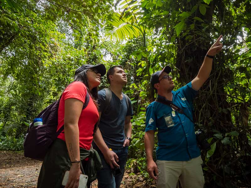
A group of people standing next to each other in a forest .

See the attractions of Turrialba

The monument is located two hours from San José on the highway to the picturesque region of Turrialba. We recommend that you take full advantage of what this region has to offer, with its culinary offerings, adventure tourism and the slopes of the volcano.

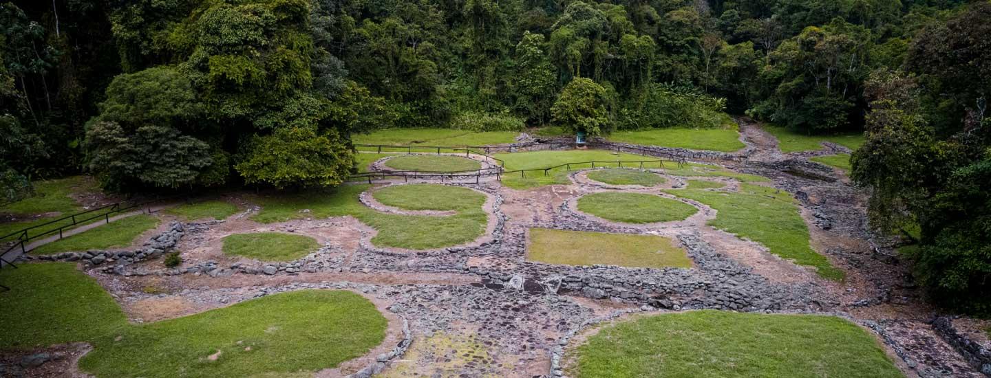
The Guayabo National Monument covers an area of about 20 hectares, which includes the entire archeological site. It can take 20 to 30 minutes to walk through the structures, depending on your pace.

This is a place with the perfect natural surroundings for your next weekend. Some of the animals you might come across are the crested guan, three-toed sloth, eyelash viper, crested owl, as well as species of frogs, hummingbirds, bats, butterflies, coatis, spiny lizards, and others. In fact, we were lucky enough to spend over an hour observing a crested owl – it’s truly marvelous!

There is also a picnic area outside of the archeological site where you can prepare a delicious meal for your family and friends

A dirt road in the middle of a jungle.

Civilizations

The main attraction, of course, is the history imbued in the site. The monument contains archaeological structures that were inhabited from 1000 BC to 1400 AD. The zenith of its development was reached around 800 AD.

Its structures include 43 mounds, three aqueducts, two squares, two roads and one enclosure, all of which are connected by minor roads, bridges and steps. The mounds are the largest structures.

According to historians, the economy of the indigenous people was based on agriculture, hunting and fishing. The reason for which the site came to be inhabited remains unknown, as well as the reason for its abandonment a century before the Spanish conquest.

Another interesting fact to mention is that the site is located in the cultural region referred to as the Intermediate Area, which stretches from Alajuela province in Costa Rica to northern Ecuador and the Orinoco River in Venezuela.

Our guide mentioned that visitors are encouraged to spend no more than 30 minutes in the area with the structures in order to protect the site. The protected area also admits only a limited number of people. Weekends see the highest number of visitors.

Before we forget, there is also a lookout that offers you a panoramic view of the settlements.

Ready?

The Guayabo National Monument covers an area of about 20 hectares, which includes the entire archeological site. It can take 20 to 30 minutes to walk through the structures, depending on your pace.

A family getaway that’s easy on the wallet

We often think that heading out on holiday requires a lot of money, but that’s not always how it is. That’s why we wanted to show you a place where you can get out of the house without spending too much.

35 km from San José

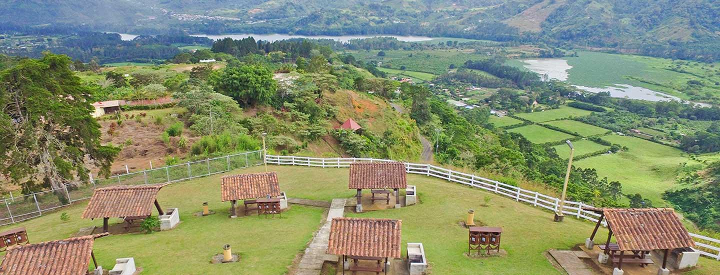
The Mirador de Orosi (Orosi Lookout) is a special place where you can spend time with your family, or bring your partner for an anniversary celebration.

So head to Cartago and enjoy a very pleasant Saturday or Sunday. In fact, it is only 35 km (22 miles) from San José and, on average, it takes about 1 hour and 20 minutes in car, depending on traffic. Admission is free!

Come and enjoy its excellent weather and the cool breezes you’ve been waiting for. In addition, since it is owned by the Costa Rican Tourism Board (ICT) admission is totally free of charge – just one more reason to visit.

Get your fruit basket and other supplies ready and prepare to enjoy these verdant surroundings.

A scenic view of a small town in the mountains.

What do I need to know?

  • Hours of operation: Seven days a week from 8:00 a.m. to 4:30 p.m.
  • Price: Free entry
  • Services: Children’s playground, green areas, restrooms. Accessible under the provisions of Law 7600 on equality of opportunity for persons with special needs. There is also plenty of space to move around, barbecue spots, drinking water, security, picnic tables, and parking.
  • Bus service: From Cartago on the Orosi or Cachí route.
  • Address: 3 km (2 miles) from the Paraíso de Cartago church on the road to Orosi.

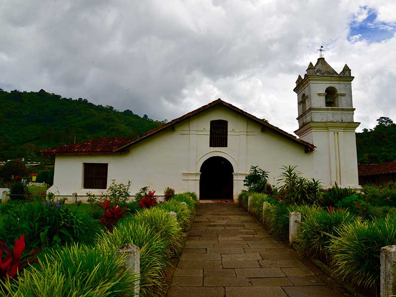
A white church with a steeple surrounded by greenery.

We often think that heading out on holiday requires a lot of money, but that’s not always how it is. That’s why we wanted to show you a place where you can get out of the house without spending too much.

A site with a rich history

Ujarrás is a town in the Cachí District of Paraíso Canton in Cartago, which in addition to its privileged setting in the Orosi Valley, holds a wealth of history from our ancestors. We were to this beautiful area of Cartage and we will tell you what we saw...

Enjoy with your family at no additional cost

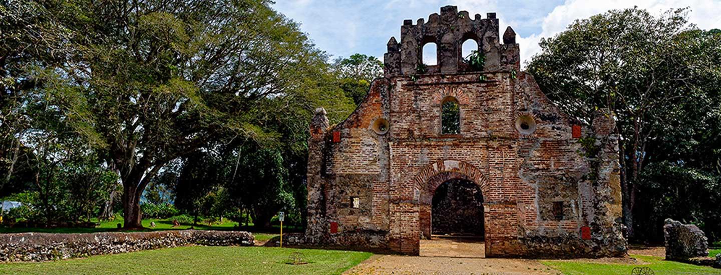
Among its most popular tourist attractions are the country’s oldest buildings, including the Catholic Templo de la Purísima Concepción del Rescate in Ujarrás.

According to the story, the current temple was built between 1691 and 1693 by the order of Governor Gómez de Lara. This old construction was made with stone and lime, the traditional system of the time. A stone cross sitting in the middle of a courtyard.

Enjoy a traditional caldosa

The ruins of Ujarrás are waiting for you to discover the beauty of their surroundings and enjoy a garden that will make your daily stress melt away.

In addition, you can enjoy a delicious, traditional caldosa (corn chips and ceviche) prepared by local businesses.

Free admission

We took some great photos of the beautiful landscapes here, you can too!

More information

  • Address: 5 km (3.2 miles) east along the highway to Cachí.
  • Services: Picnic tables, barbecue areas, drinking water, green areas, restrooms.
  • Bus service: From Cartago on the Orosi or Cachí route.

A group of people standing in front of a stone building.

A site with a rich history, Ujarrás is a town in the Cachí District of Paraíso Canton in Cartago, which in addition to its privileged setting in the Orosi Valley, holds a wealth of history from our ancestors.

Tour Cartago on the cheap

Take the vacation that you or your family have been looking forward to!
Cartago is a beautiful province that offers a variety of free destinations where you can go to enjoy your next day off or weekend.

Have lunch in the great outdoors

Just 2 km (1.3 miles) east of the church of Paraíso de Cartago, there are peaceful green areas for you to enjoy.
The lookout is ideal to feel sit and read a good book, admire nature and share lunch on their picnic tables

Visit the Cachí dam as well

Just like the Mirador de Orosi, admission here is completely free of charge. The two are also not far apart, so you can see both in a single day.
In addition, just 8 km (5 miles) away you can see the Cachí dam, which is worth a look.

Everything you need to know

  • Hours of operation: Seven days a week from 8:00 a.m. to 4:00 p.m.
  • Address: 2 km (1.3 miles) east of the church of Paraíso
  • Admission: Free
  • Services: Children’s playground, green areas, restrooms. Accessible under the provisions of Law 7600 on equality of opportunity for persons with special needs. There is also plenty of space to move around, barbecue spots, drinking water, security, picnic tables and parking.
  • Bus service: You can take a bus behind the Sagrado Corazón School, just across from the Parque de las Ruinas in Cartago. Driving from San José takes about an hour.

A lush green valley surrounded by mountains under a cloudy sky.

Take the vacation that you or your family have been looking forward to! Cartago is a beautiful province that offers a variety of free destinations where you can go to enjoy your next day off or weekend.

Cartago has always been a great destination to get away from the hustle and bustle of the big city. We wanted to do a bit of hiking and so we headed towards one of the massifs located in the province, specifically in the Volcán Irazú National Park.

We left downtown San José and drove for 51 km – it was a trip of about an hour and a half (see directions). When we got to Cartago – the Pacayas area, more specifically – we met several farmers working the land and others selling their products on the side of the highway. It’s an obligatory stop to purchase fruits, vegetables, a variety of cheeses and even flowers – all the better because we were supporting the local farmers.

We had just left the car when a group of coatis greeted us. They got up close to ask for food, but it’s important for visitors to know that giving animals food in the country’s national parks is forbidden.

Majestic views

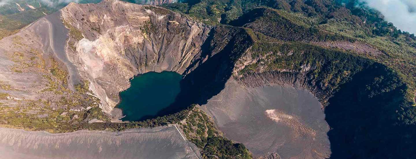
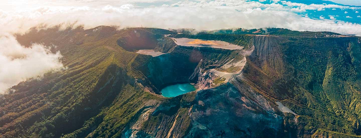
The day was sunny, though it is normally quite cold at the peak (5-10°C) so it’s a good idea to bring warm clothing. It’s the highest volcano in Costa Rica at 3,432 meters (11,260 ft) above sea level. It has 5 craters, the largest of which measures 1.5 km (0.9 miles) in diameter and 300 m (985 ft) in height. Due to its position high in the Central Volcanic Range, it is a strategic point for telecommunications infrastructure, which is why several antennas can be seen at the peak for this purpose.

The path along its craters is truly invigorating – the paths are protected by security barriers that may not be crossed. The day we visited was quite cool with a clear sky. We recommend that you arrive early so that you’ll be just as lucky, as the peak often gets cloudy by midmorning. We were able to look down into the main crater and see the lake at the bottom, with spectacular sunflower tones of yellow and green.

In addition, there is the Playa Hermosa and Diego de la Haya craters, as well as the Sapper formation, which is the highest point on the mountain, from where you can see Costa Rica’s Pacific and Caribbean coasts.
In addition to information, visitor services include park rangers, trails, restrooms, a café and several natural lookouts.

Origin of the name

Irazú is derived from the language of the indigenous people who used to live in the area and means “peak of tremors and thunder” because of the several eruptions that the volcano has experienced over the course of its history.
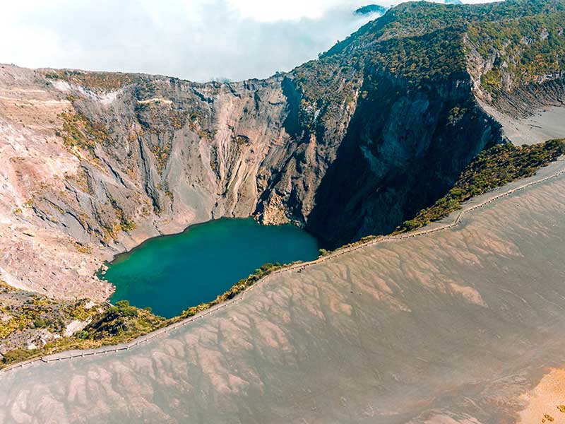
An aerial view of a mountain and a lake.

Volcanic activity

The first large recorded eruption occurred in 1723, which destroyed the city of Cartago, which at the time was the capital of Costa Rica, while also covering much of San José in ash. This activity was documented by Diego de la Haya, which is why one of the craters bears his name.

Another one of the most memorable eruptions occurred in 1963, right when the country was hosting the former US President, John F. Kennedy. An accumulation of volcanic materials in the Río Reventado waterway caused an avalanche that destroyed around 300 houses in the city of Taras de Cartago. The volcano remained active for two more years after that date, gushing lava in powerful explosions.

In 1994, a sudden explosion occurred on the northern wall of the main crater, which produced an avalanche that spilled down to the Río Sucio waterway, coming to a stop on the other side of the bridge over the river located on the Braulio Carrillo highway. Since then, the volcano has only exhibited volcanic activity on the northern wall of the main crater.

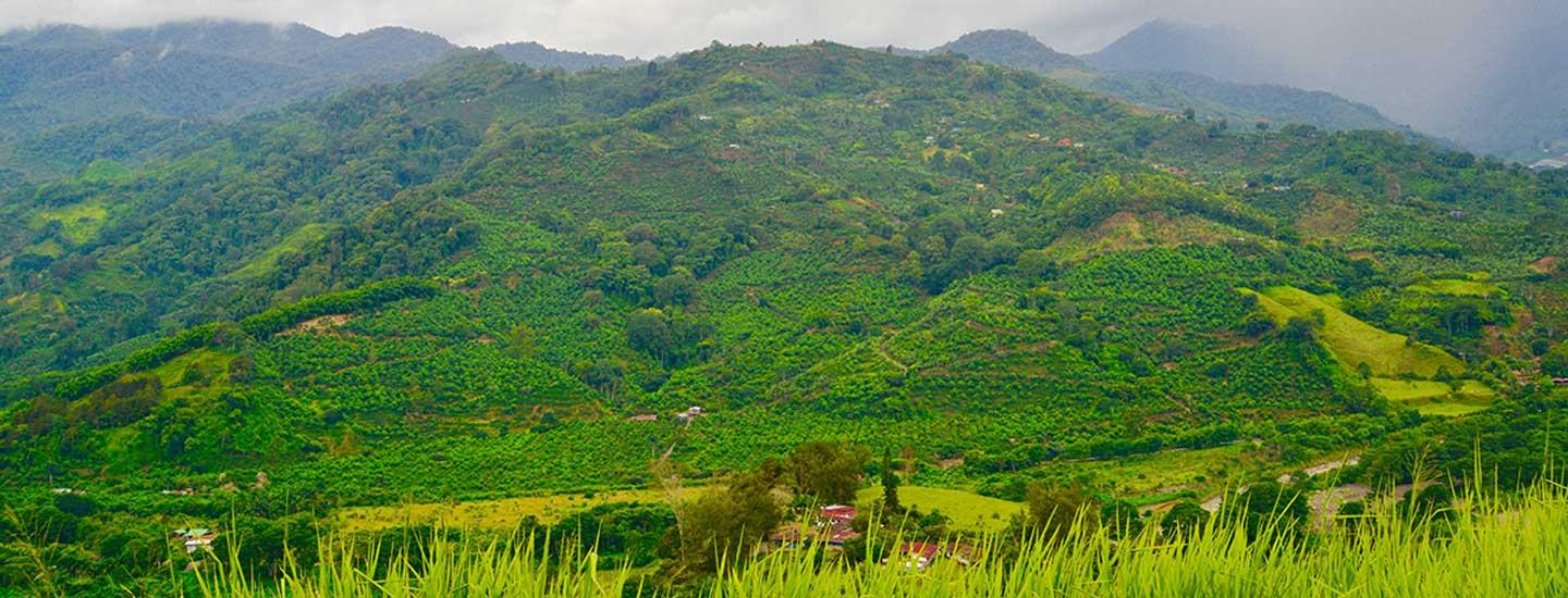
All of the volcanic activity has made the region particularly ideal for agriculture, since the soil is very fertile. Visitors here will see many farms dedicated to cultivating strawberries, potatoes, onions, exotic flowers and milk.

Volcanoes are unpredictable, but visiting Irazú is completely safe. If any eruption hazard is detected that would represent a risk for visitors to the volcano, the park would be evacuated with plenty of time to spare.

Volcán Irazú National Park

The Volcán Irazú National Park was created by Law No. 1917 on July 30, 1955. It was later expanded by Executive Order no. 26945-MINAE of August 22, 1988 to its current size of 2,000 hectares.

The park is comprised of the observation facilities that overlook the volcano and its craters, as well as the sector known as Prusia. There are facilities to enjoy a picnic with food and drink that you bring (alcoholic drinks are not allowed), as well as hiking trails.

Flora and fauna Around 25 km2 (9.7 sq. mi.) are protected, which are home to many interesting species of plants and animals.
The plant growth is a sight to behold: it is arid at first glance, and looks like the moon. Tall pines are present further down, as well as the large leaves of “poor man’s umbrella”.

There are very few animals due to the volcanic activity. However, visitors can see robins, owls, hummingbirds, porcupines, rabbits, agoutis, coyotes and foxes in the area.

The Prusia area has 16 km of trails where you can enjoy a moment of relaxation in the middle of the natural surroundings. The zone is visited often by fitness buffs or trail-runners.

Various rivers and creeks have their source in the park, including the Reventazón, Sarapiquí, Sucio and Toro Amarillo.

Hours of operation Every day from 8:00 a.m. to 3:30 p.m. Includes holidays.

Services

  • In the Cráteres section there is a parking lot, café, restrooms with access for persons with disabilities, an information kiosk located on the path to the main lookout, as well as three roofed picnic areas.
  • The Prusia section contains the El Roble, Micaela, La Gruta, Chiverrales, Cabeza de Vaca, El Ahorcado, El Puma and Los Abuelos trails, as well as picnic areas, restrooms and running water.

Contact people:

  • Cráteres section: 2200-5025
  • Prusia section: 2200-4422

How do we get there?

By car

  • Cráteres section: From San José, take the Florencio del Castillo highway and follow signage for Volcán Irazú (route 219). The volcano is 33 km (20 miles) north of Cartago.
  • Prusia section: The route is the same as for Volcán Irazú, except that once you reach the Catholic church of Potrero Cerrado, you will need to follow the highway for 2 km (1.3 miles), turn left and keep going for 4 km (2.5 miles).

By bus

  • The first option is a bus that leaves every day in front of Hotel Costa Rica in San José at 8:00 a.m. with a stop in Cartago. It stops on the east side of the Antiguo Cuartel (Tierra Blanca stop) around 8:40 a.m. and reaches the volcano around 10:00 a.m. It returns at 12:30 p.m.
  • The second bus leaves Cartago at 12:00 p.m. from the Tierra Blanca stop. It reaches Irazú at 1:10 p.m. and returns at 2:55 p.m.
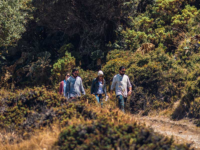
A group of people walking down a dirt road.

Recommendations

  • Use comfortable clothing and closed-toe shoes for hikes. On sunny days you should use a hat and sunscreen; on cloudy days use a jacket or raincoat.
  • Since it is an area with volcanic activity, it is important that you pay attention to the regulations put in place by park rangers to protect you in the event of an emergency.
  • Remember that on days with high attendance, you will probably have to wait in line to use the restrooms.
  • Weather conditions at the peak of Volcán Irazú change rapidly, meaning that there is no guarantee that you will be able to see the craters. Check the weather conditions before your visit.
  • In the picnic areas, be careful around raccoons and agoutis that try to rob food.

It is important to be aware that, like other protected wildlife areas, the following is not allowed in Volcán Irazú National Park:

  • Entering in a state of drunkenness or after having taken drugs.
  • Entering with domestic animals or pets.
  • Removing rocks, plants or other natural resources from the wilderness area.
  • Leaving the trails or areas designed for public use.
  • Smoking (Law 9028).
  • Littering.
  • Feeding wildlife.
Cartago has always been a great destination to get away from the hustle and bustle of the big city. We wanted to do a bit of hiking and so we headed towards one of the massifs located in the province, specifically in the Volcán Irazú National Park.

We had been planning on going to check out Dota, located towards our country’s southern region. Finally, things were coming together! The summery climate was an invitation to pack our bags and begin the journey to the village of San Gerardo, a place bursting with natural beauty.
We left downtown San José nice and early with our jackets in hand, bracing ourselves for the famously cold climate of Cerro de la Muerte, which we would pass on our way. As we progressed on the route, landscapes began to appear around us, including the towers of the Los Santos wind park. Then, we stopped for the mandatory breakfast en route and kept going towards San Gerardo.

Escape the daily grind

Dota is the 17th canton of San José province, which forms the Los Santos Region alongside the cantons of León Cortés and Tarrazú. It has an area of around 400 km2, which makes it the fourth-largest canton of San José, and is divided into 3 districts: Santa María (its main district), Jardín and Copey.
If you want to get away from the rat race, San Gerardo de Dota is one of the best places to do so. It’s a place full of natural beauty and hard-working people, where you can watch birds, enjoy rivers full of crystal-clear water and cascades, trout fishing, trails through the cloud forest, and visits to the Los Quetzales National Park - there are so many activities that await you.
San Gerardo is a community bordering the Los Quetzales National Park located at 2,200 meters above sea level, hidden in the folds of the Río Savegre Valley.

A group of people sitting on a bridge over a river.

Observing quetzales

The quetzal’s exotic beauty makes it one of the most iconic birds in the world. San Gerardo offers opportunities to see them, since the cloud forest is the bird’s ideal habitat and the source of its preferred food, the fruit of the aguacatillo tree. Its nesting season is between the months of April and May, which means that it is easier to see them in this region of the country during this time of year.

Hiking on the mountain

If you love hiking, plenty of routes crisscross the forest and allow you to admire the many ecosystems that this part of the country has to offer. You’ll find gorgeous places to take photos and sit down to enjoy the sounds of nature. Don’t forget to bring something to protect yourself from the cool rain, since the climate tends to stay at a cool 13-18°C depending on the time of year you visit. Take something to eat and to keep yourself hydrated, but remember not to leave any garbage.

Río Savegre: trout fishing

This community extends along the banks of the Río Savegre, whose clear water is usually bracingly cold Caves and cascades can be seen throughout the river’s course. If you enjoy fishing, you’ll find delicious trout abounding in this river. Keep in mind that the fly-fishing season is from May to June and the bait-fishing season from December to March. Most restaurants in the area have menus that feature this fish in a variety of dishes. You'll enjoy trying our every different recipe!

A group of people sitting on a rock looking at a waterfall.

Los Quetzales National Park

Los Quetzales National Park was created in 2005 and extends over an area of 12,355 acres. It has 3 kinds of forest and 14 different ecosystems. Its trees permit the observation of a large number of bird species including quetzales, tangaras, trogons and hummingbirds.

Río Savegre waterfalls

The walk to the waterfalls is stunning. The landscape is an open invitation to spend a moment takingin the scenery and snap a few photos. The trailhead is about 500 meters down the road from the Posada de Turismo Rural Sueños del Bosque Lodge, which is where we are staying. You’ll see the entrance on the left, then head over a bridge and the trail to the first waterfall will be to one side once you get to a trout farm. After a 40-minute hike, you’ll see a couple of enormous rocks ahead of you: a perfect place to take some photos!
A little further along the trail, you’ll see a small footbridge that goes over the cascade. You can stand on it and take in the falling water. If you keep walking (optional, since the trail isn’t in the best state from here on out), you’ll go down some stairs and arrive at the cave formed by the senormous rocks below the waterfall. Before going in, we recommend that you act with extreme care and check the river’s water level so that you are not at any risk from a flash flood filling the cave with water.
If you continue along the trail, a storybook scene awaits: it’s clear that not many people come here because everything looks green and healthy. There is a hanging bridge that passes over the river; crossing it is quite the experience. We headed further along into the river and after heading up and down a series of stairs, we found ourselves face-to-face with a breathtaking waterfall. The climate here is a little colder, so bathing is less recommended – all the more because the currents can be dangerous. The lookout where you can admire the scene is quite small, but it is really worth the trouble to get there. It’s so beautiful!
Do you want to experience this adventure for yourself?

A walkway in the middle of a lush green forest.

How do we get there?

The village of San Gerardo de Dota is situated along the ridges of the Cordillera de Talamanca. Traveling from downtown San José you’ll need to travel some 78.9 km south along the Inter-American Highway until you reach the turnoff next to the Soda San Gerardo, which you will see on your right. Head down the road, which will take you down the mountain. We stayed in Sueños del Bosque Lodge, which is 9.2 km along that road.

  • What should I take? Sunscreen, jacket, raincoat, hat, easy-drying clothes, hiking shoes, bathing suit, towel, a snack and something to keep hydrated.
  • Difficulty: Intermediate - High (depending on how far you want to go, some of the trail sections are damaged).
  • Distance: 4 km (there and back).
  • Parking: No. Parking is available on the roadm or you can leave your vehicle in the accommodations you choose.
  • Cost: Free of charge.


San Gerardo is a community bordering the Los Quetzales National Park located at 2,200 meters above sea level, hidden in the folds of the Río Savegre Valley.

If you think you know what an adrenaline rush feels like, just wait until you visit the Pacuare river. Are you brave enough to join us?

We left from San José at 7 in the morning and headed towards Turrialba. We took this route because we had to pass through the entrance of a well-known cattle farm that is located on the border between the province of Cartago and Limón.

When we arrived at the departure point for the tour an experienced guide known as “El Chino” welcomed us with a big smile. Randall Solano, known as “El Chino”, has been navigating the waters of Pacuare for more than 25 years. We put on our life jackets and helmets while the staff gave us a brief talk on water safety.

Yet again Costa Rica surprised us with its incredible tourist options for people of all tastes. We knew that we were in for an adrenaline rush, but we didn't know that we would also enjoy so many beautiful landscapes along the route.

The Pacuare River is in the Atlantic basin and is 133 km in length. Its headwaters form in the Cuericí mountains in the Talamanca cordillera, at nearly 3000 meters above sea level. The waters of the Pacuare descend from the mountains to the plains of the Central Caribbean and drain into the Caribbean Sea.

Category II, III and IV

The tour lasts approximately 4 hours, so you have to come prepared to experience a real aquatic adventure. Bring plenty of sunscreen and water to hydrate yourself along the route.

About five minutes after starting the tour we hit some class II rapids, just enough to shake away our nerves and gave us a little more confidence.

Max was the other guide with us. Just like Chino, Max exuded professionalism, taking care of us the whole time and alerting us when we were approaching another set of rapids.

Before each rapid, Max would give us a quick briefing on the category of the rapid and the correct rowing technique to avoid any accidents in the water.

During the trip we also saw several species of birds, and waterfalls falling between the enormous rocks that line the canyon.

After an hour and a half, we stopped to check out lodge on the banks of the river. As soon as you enter and see the fantastic balconies at the lodge, you are going to want to spend the weekend there watching sunsets with a nice cup of coffee and a good book.

A river running through a lush green forest.

Fall in love with the lodge

The lodge is in the middle of the jungle, surrounded by the sound of birds singing and the roar of the river. The lodge or "ecolodge" was sustainably built with reclaimed wood and is located within a private reserve of more than 2000 acres. Here you can go hiking, take a canopy tour, go cayoning, enjoy horseback riding, do some community tourism or simply disconnect from everything and enjoy a relaxing rest in a hammock overlooking the river.

We left the lodge with the hopes of returning one day, but there was still so much adventure to be had, so we grabbed our oars and set out on the water. We were in for a wild time!

Forward 2, forward 3, forward stroooong! Max and Chino shout back to us that we still had to test our mettle on some category III and IV rapids.

After a delicious lunch prepared by our friendly guides (who, by the way, are excellent cooks!), they had a surprise in store for us...

A few meters down the river, we would find ourselves facing a category IV rapid. We truly experienced the saying "after a storm comes a calm". We paddled very hard across the category IV rapid, only to arrive at a beautiful waterfall that shook us about under its great power. Max steered the raft toward the fall and we were soaked!

After a few more rapids, we arrived at the long-awaited Pacuare canyon, where the channel narrows, the stone walls are impressive and the water is calmer, it was enough to just breathe in and admire the phenomenal landscape.

To close with a flourish, we passed under the Atlantic railway line at the precise moment that a train loaded with containers passed overhead. We reached the end of the tour with the sound of the train's whistle congratulating us for our accomplishment.

After 4 hours we can say that we dominated this amazing rafting adventure. We would do it all again in a heartbeat.

Have you bested the Pacuare River?

If you think you know what an adrenaline rush feels like, just wait until you visit the Pacuare river. Are you brave enough to join us?
Subscribe to Cartago Province