
The refuge is located in Los Ángeles Sur in Río Cuarto, the newest canton of Alajuela Province.

Laguna Hule, Laguna Congo and Laguna Bosque Alegre are three wetlands that are part of the refuge and the Central Volcanic Cordillera Conservation Area.

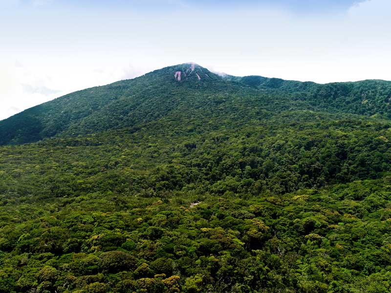
The wetlands are located 11 km from the Poás Volcano and 8 km from the town of Cariblanco.

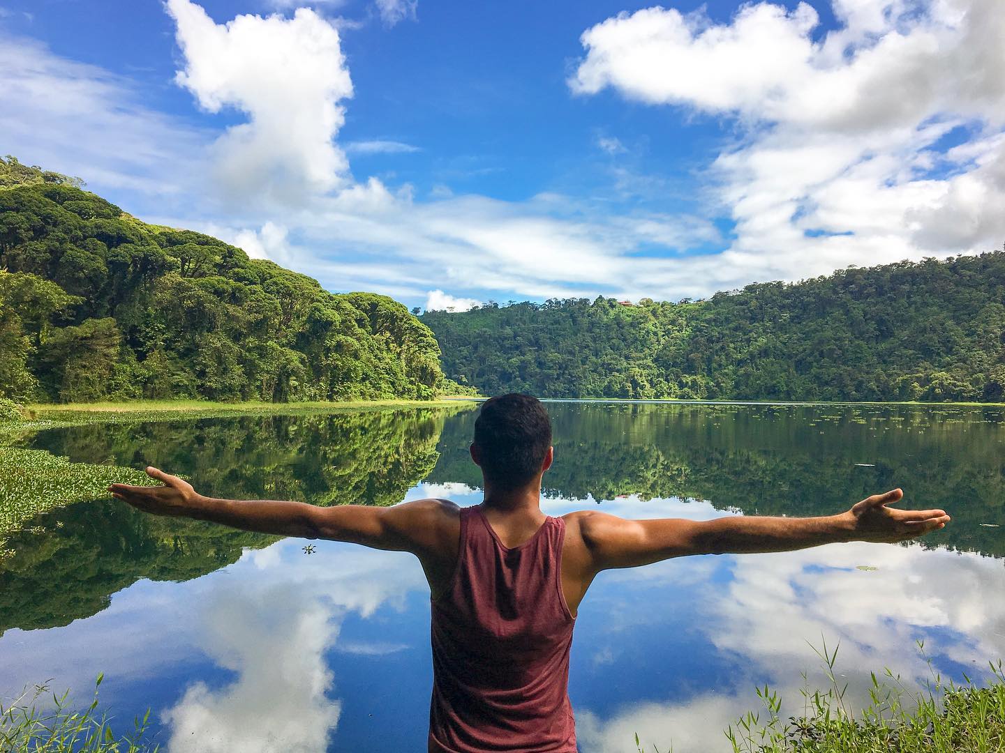
The largest of the three is Laguna Hule – those familiar with the area know how incredible it looks from the viewpoint. It is 1,150 m across and over 26 m deep, and is located at an elevation of 400 masl.

bosque alegre

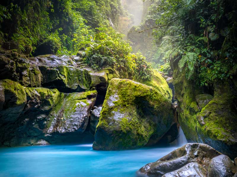
The second-largest is Laguna Congo, which is 14.6 m deep and extends over an area of 15 ha. To reach the wetland, you’ll need to take a right off of the trail leading to Laguna Hule and walk about 3 km further along a densely forested trail with some muddy patches. Laguna Congo has a bewitching greenish color, making it perfect for photos.

Finally, the smallest is Laguna Bosque Alegre, which is hardly ever visited because of the lack of a trail leading to it.

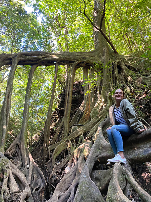
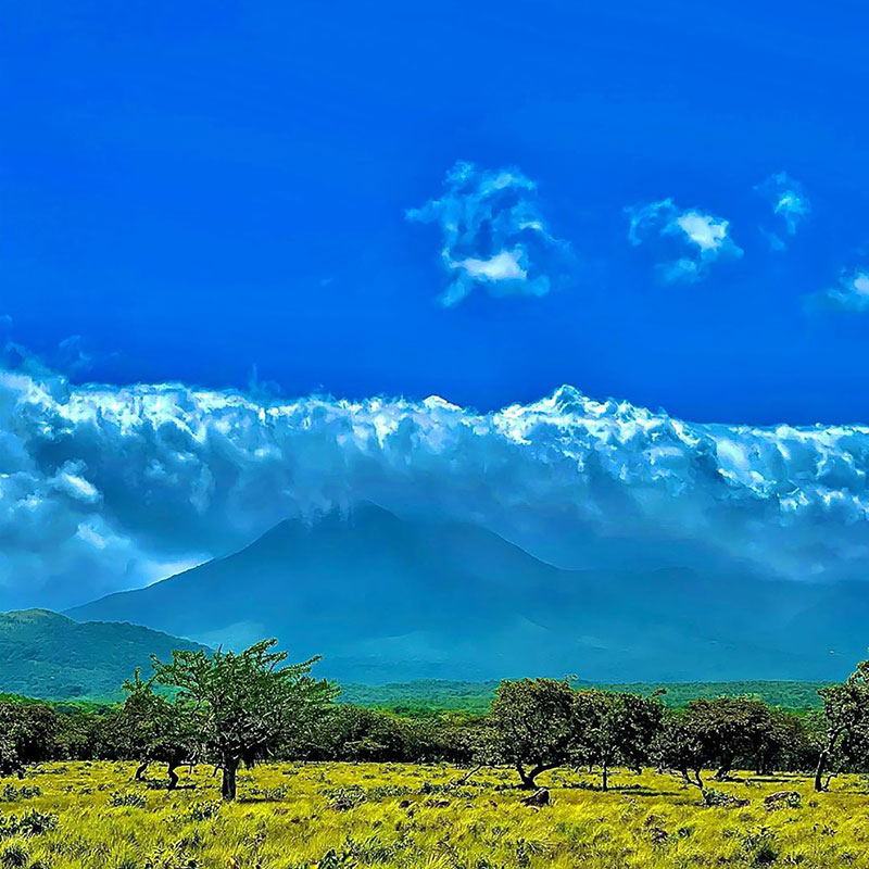
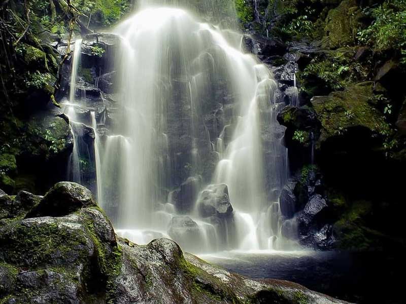
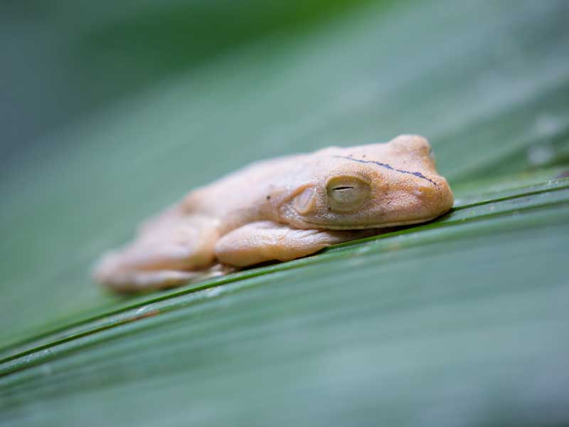
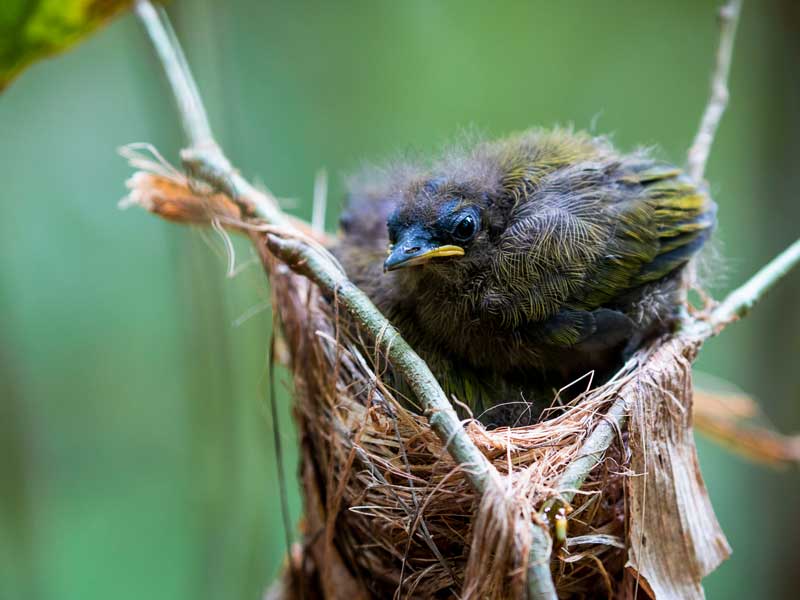
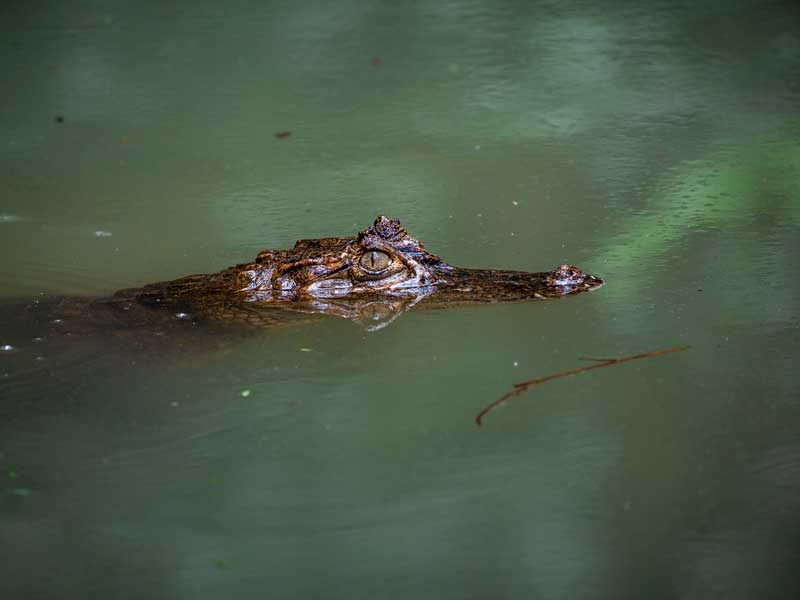
The area around the wetlands is filled with incredible biodiversity. You might come across animals like armadillos, white-faced capuchin monkeys and howler monkeys. It is also home to 170 bird species.

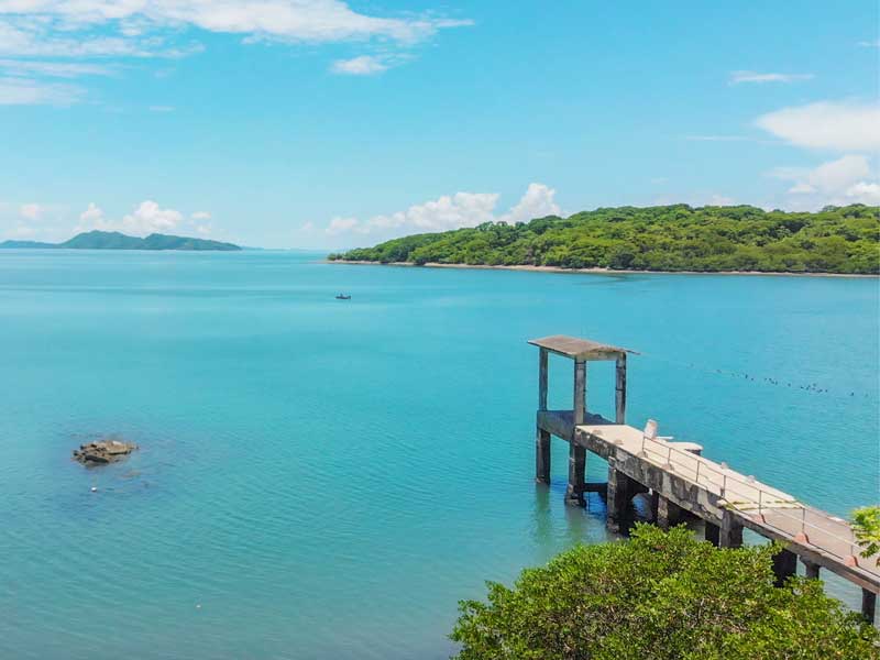
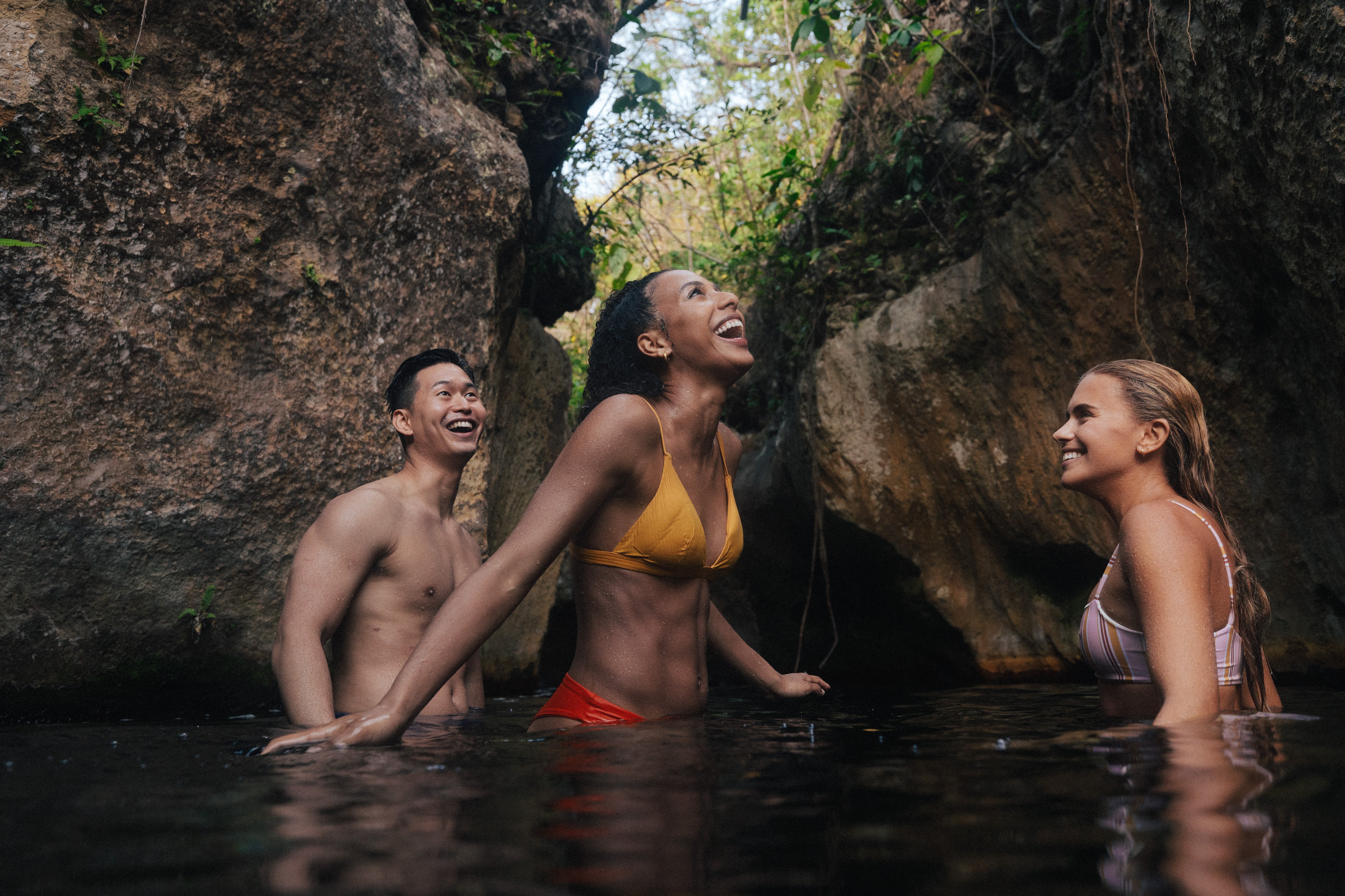
The activities you will be able to enjoy include fishing, kayak trips, camping, hiking and even going for a nice swim.
You can also have lunch at the restaurant by the viewpoint, or you can bring your own picnic and dine by the shores of Laguna Hule.

Don’t forget!

Comfortable hiking shoes, rain jacket, swimsuit, towel, sunblock, insect repellent and snacks for the hike.

What are you waiting for? Explore this attraction with your family and friends. Come and see more of the countryside, you won’t regret it.

Additional information:

Vehicle: you can reach the trailhead in an automobile or a 4x4.
Parking: yes.
Pets: yes.
Camping: yes.
Cost: free.

How do you get there?

To visit these wetlands, first take Ruta 126, which connects Varablanca/Cinchona and Cariblanco. Once you’ve reached Cariblanco, take the gravel road to Los Ángeles for 6.5 km. You’ll turn on to the Los Ángeles road in the community called Nueva Cinchona. You can leave your vehicle in the park by the Mirador Bosque Alegre. From there, you’ll only have to walk for 500 m to reach Laguna Hule. We recommend that you use your favorite GPS app to plan your route from your starting point.

The refuge is located in Los Ángeles Sur in Río Cuarto, the newest canton of Alajuela Province. Laguna Hule, Laguna Congo and Laguna Bosque Alegre are three wetlands that are part of the refuge and the Central Volcanic Cordillera Conservation Area.

Barra del Colorado National Wildlife refuge is located in the northeast of the country on the Caribbean coast. Created in 1985, it covers a territory of 81,177 hectares of land area that is comprised of coastal areas, lakes, rivers, wetlands, flooded forests and small forested hills that do not exceed 219 masl in elevation. 

 aerial view of river through jungle

One interesting detail about the refuge is that wildlife conservation is carried out in harmony with the communities who live in the area, making it an ideal place for rural community tourism.

As with national parks, the refuge designates areas for various kinds of conservation:

  • Sustainable use: 61%
  • Absolute protection: 35%
  • Special use: 3%
  • Public use: 1%

The 1% of the area set aside for the public is around Cerro Tortuguero, at the far southeastern point of the Barra del Colorado National Wildlife Refuge. With an altitude of 119 meters above sea level, this small conical hill is of volcanic origin and was formed around 1.8 million years ago.

Cerro Tortuguero sector is located at the edge of Tortuguero National Park and is just 10 minutes from the community of Barra de Tortuguero, making a visit to the park an easy side trip for those heading to the country’s famous ecotourism offerings in Tortuguero.

Due to the hill’s ecological fragility and the limited space at the peak, the number of visitors allowed per day is controlled in order to ensure the conservation of its natural resources, maintain its infrastructure and offer a quality experience. The services of the refuge are offered in partnership with a local organization that generates economic benefits for the nearby communities.

Some of the species you can see in the refuge include: howler monkeys, white-faced capuchins, spider monkeys, red frogs and the great green macaw.

Atractions

A narrow river surrounded by lush green trees.

Boardwalk: built to reduce visitors’ impacts on the soil, this boardwalk makes it possible to access the area and walk from the base of the hill to its peak.

Cerro Tortuguero lookout: as the highest peak in this area of the Caribbean, it offers a unique view of the true dimensions of the Tortuguero jungle.

Community of San Francisco: this small village is known for its simple way of life and Caribbean traditions, which intermingle with the region’s characteristic natural surroundings.

Services

  • Quay
  • Restrooms
  • Boardwalk
  • Rest areas
  • Observation deck

A river running through a lush green forest.

Hours of operation:

Seven days a week from 8:00 a.m. to 4:00 p.m. Maximum 330 people per day. Reservations are required (through hotels, agencies or operators). Guides are required. Admission limited to groups of up to 10 people. Groups must enter separately every 15 minutes. 

Barra del Colorado National Wildlife refuge is located in the northeast of the country on the Caribbean coast. Created in 1985, it covers a territory of 81,177 hectares of land area that is comprised of coastal areas, lakes, rivers, wetlands, flooded forests and small forested hills.

Monteverde never ceases to surprise us. On our last visit, we were able to discover some of the secrets its mountain has been keeping. 

We love finding new options for getaways with family or friends, which is why we’re here to tell you about a free destination that’s just 5 minutes from Santa Elena town.

  woman sitting next to tree roots above ground

It’s a natural bridge that the community calls “Ficus la Raíz,” meaning something like “The Fig Root.” The bridge is formed by a tree that fell over, but whose roots kept growing vertically down. The small creek that passes underneath washed over the roots, exposing the shape of the tree’s skeleton even more.

Many visitors come here to see it and climb up the bridge to take pictures. However, this is not recommended due to the height of the roots, which can become slippery during the rainy season. Even so, you can take incredible photos from below and enjoy the natural surroundings.


A woman sitting on top of a tree in a forest.
Although there is no designated parking area, you can leave your vehicle at the side of the road, which has a curve near the trailhead, or in the town of Santa Elena, which is a 15 minute walk from the natural bridge. Once you’re there, you’ll walk down some steps for about 100 m to reach the bridge. The walk down is short and easy.

We recommend that you bring walking shoes, water and a change of clothes. And don’t leave your jacket behind, as Monteverde can get quite cool and windy in the afternoons. As we mentioned, admission is free. All you have to do is make sure not to leave any garbage in the area and take some awesome photos.

What are you waiting for? Make your next trip to Monteverde! It’s a magical place that’s full of views of the sea, hotels that disappear among the mountains and incredible food.


Location: Santa Elena de Monteverde.
Admission: free.
Location: https://goo.gl/maps/n8GyF7BkKVXLsb1Y8

Make your next trip to Monteverde! It’s a magical place that’s full of views of the sea, hotels that disappear among the mountains and incredible food.

This park is located to the east of Ciudad Quesada and is surrounded by the districts of Aguas Zarcas, Venecia, Laguna, Tapezco, Altamira, Sarchí, Toro Amarillo and Río Cuarto, among others. rocks with moss and waterfall in jungle


It has an area of 14,453 ha and was created to protect three volcanoes: Volcán Platanar, with an altitude of 7,162 ft, El Porvenir, at 7,428 ft, and El Viejo, at 6,969. All three volcanoes are inactive. It is also important for the protection of five rivers that run through the region: Río Platanar, Río Toro, Río Aguas Zarcas, Río Tres Amigos and Río La Vieja.

The park is home to an immense variety of flora and fauna. Visitors may come across mammals like coyotes, deer, ocelots, tapirs and several species of bats. There are also birds such as the resplendent quetzal and peacock, among others.

The region has various types of ecosystems, including tropical rainforests and tropical lowland, premontane and mountain forests.

The park is endowed with hot springs that flow into the rivers thanks to the region’s geothermal activity. In addition, it is important due to the history of ancient civilizations it contains and is frequented by birdwatching enthusiasts and those wishing to explore old-growth forests.

It is important to mention that the trails in the park are not well signposted; it is recommended that you ask for assistance from local guides to avoid any confusion while hiking. Don’t forget to bring comfortable shoes and a rain jacket, since the weather can be unpredictable and you may need an additional change of clothes. Also, make sure to let the park know of your visit in advance in order to coordinate logistics and to be aware of any issues that may arise in the park.

Remember that you will also be near the Toro Amarillo district, which is rich in waterfalls, hiking trails, sky-blue water and the perfect accommodations to be in touch with nature. Think about staying for a weekend or planning your vacations to visit this beautiful spot.


A mountain range with trees and clouds in the background.


For more information:

  • Telephone: 2200 5644
  • Hours of operation: 8:00 a.m. to 4:00 p.m.
  • Rates: Residents ₡800 / Non-resident foreigners: $10
  • Email: acahn.pnajuancastroblanco@sinac.go.cr

How do you get there?

From San José, take the Interamericana Norte to Naranjo, where you’ll pick up the road to Ciudad Quesada via Zarcero. The park entrance is east of Ciudad Quesada.

Juan Castro Blanco National Park is located to the east of Ciudad Quesada and is surrounded by the districts of Aguas Zarcas, Venecia, Laguna, Tapezco, Altamira, Sarchí, Toro Amarillo and Río Cuarto, among others.

This reserve is part of the Tempisque Conservation Area, along with Isla Negritos Biological Reserve (covering the two islands) and Los Pájaros Biological Reserve.

They are located in the Gulf of Nicoya facing Playa Naranjo, and can be seen from on board the Puntarenas ferry on its way to and from Paquera.
A small island in the middle of a body of water. 
This island faithfully protects the many species of migratory birds who visit it during winter to nest. Some of the best-known species include the brown pelican (the island is home to one of the largest populations in Costa Rica), seagulls, peregrine falcons, white-tipped doves and boobies. Approximately 200 species of birds call Isla Guayabo home.

The Isla Guayabo Biological Reserve, which juts out 50 m above the surface of the water, extends over a total area of 15 hectares and is located 8 km from Puntarenas. The island used to be more imposing, but the passage of time has caused it to slowly disappear beneath the waves, leaving only its very tip above the water.

The island is mainly comprised of sedimentary rocks and is covered in shrubs and small thorny plants in some areas. Trees like the guaco and higuerón are common on the island, as well as the coyol and viscoyol palms.

Several species of crustaceans also inhabit the island, including fiddler crabs, European green crabs, giant conches, oysters and a wide variety of fish and insect species.

The region experiences a dry season from January to March. Currently, it is not possible to enter or walk on the island, with only boat visits allowed due to the conservation and protection rules in effect. However, you can watch birds and see the nesting sites up close.

The Isla Guayabo Biological Reserve is known for its breathtaking cliffs all around its perimeter as well as a white sand beach and crystal-clear water. 

Hours of operation: One of the departure points is the Puntarenas dock, where you’ll find various tour agencies that offer this trip on their boats or catamarans. Some of the trips that go to Isla Tortuga pass by the surrounding islands and generally start at 7:30 a.m., with the return trip at 4:00 p.m.
Cost: contact the tour operator directly.

More information: Tempisque Conservation Area (ACT): +506 2686-4967 / +506 2686-4968

This reserve is part of the Tempisque Conservation Area, along with Isla Negritos Biological Reserve (covering the two islands) and Los Pájaros Biological Reserve. They are located in the Gulf of Nicoya facing Playa Naranjo, and can be seen from on board the Puntarenas ferry on its way to and from Paquera.

Located in the province of Guanacaste some 36 km north of the city of Liberia, the park extends over an area of more than 330 km2.

Guanacaste National Park was created in 1991 with the aim of connecting to Santa Rosa National Park in order to create one of the world’s largest biological reserves. It belongs to the Guanacaste Conservation Area and was declared a World Heritage Site by UNESCO in 1999.

Its best-known features are its two main volcanoes. The Cacao Volcano, at an altitude of 1,659 m and the Orosí Volcano, at 1,446 m, are both conic stratovolcanoes that have not been active for thousands of years.

The park is made up of three sectors: Maritza, Pitilla and Cacao. Their main features are listed below.

A grassy field with trees and mountains in the background.

Maritza sector is located 650 meters above sea level on the slopes of the Orosí volcano. The area includes water sources and streams amidst vegetation that is in a transitional phase between a dry and wet forest. There is a very diverse population of birds and a large community of peccaries. The services available are drinking water, latrines, trails and general information.

Pitilla sector is located 1 km south of the city of La Cruz. The area mainly consists of rainforest. Those who hike along its trails can observe birds and other animals, while the area offers a spectacular view of Lake Nicaragua.

Cacao sector is located on the slopes of the volcano that gives the sector its name. At 1,100 meters above sea level, the trails in this sector traverse dry forest, transitional forest and cloud forest. In addition, those with the correct permit can climb to the summit of the volcano. This impressive park is home to a stunning array of flora and fauna. To date, over 140 species of mammals have been recorded in the area, along with more than 300 bird species, about 100 species of amphibians and reptiles, and more than 10,000 insect species.

How do you get there? 

To visit the biological stations of this national park, the visit must be coordinated with the Santa Rosa National Park. All access roads are unpaved and access can be quite complicated, meaning that the visit must be planned in detail. This national park is mainly visited by researchers and students.

Hours of operation: All visits must be coordinated with the Santa Rosa Sector.

Telephone: (506) 2666-5051  WhatsApp (506) 8886-9510

Admission: 
Costa Ricans: ₡1100.
Foreigners: $15

Guanacaste National Park was created in 1991 with the aim of connecting to Santa Rosa National Park in order to create one of the world’s largest biological reserves.

Welcome to a national park that’s infused with history, which didn’t gain its designation as a national park until September 2020, since it used to be one of the country’s wildlife refuges.

Isla San Lucas is known for its history as a prison, a role the island served from 1873 and 1991. After it was closed, it first became a wildlife refuge before being converted to a national park. That was how it went from being a prison to its current status as a historic and tourism center.

A pier in the middle of a large body of water.

The island is located in the Gulf of Nicoya, some 8 km from Puntarenas. It has an area of 472 ha and altitude ranging from 0 to 220 masl.

The region has two markedly different seasons: the dry season, from December to April, and the rainy season between May and November.

The island has also inspired a number of literary works, including a novel entitled La Isla de los Hombres Solos (The Island of Lonely Men, published in English as God Was Looking the Other Way). by José León Sánchez, and the short story La Ventana (The Window) by Carlos Salazar Herrera.

After becoming the country’s thirtieth national park, it is now a highly biodiverse tourist attraction. Here, the cries of monkeys are common, and visitors may even be lucky enough to cross paths with white-tailed deer, squirrels, iguanas, agoutis, and even lowland pacas. It is also home to 40 species of birds and 17 of reptiles.

Already planning your visit?

An aerial view of a lush green forest.

Attractions on the island:

  • El Atracadero (The Quay): Essential for accessing the island. A concrete structure jutting into the sea.
  • La Calzada de Piedra (The Stone Road).
  • La Capilla (The Chapel): A key architectural and symbolic element of the island.
  • La Comandancia (The Command).
  • Los Calabozos de Acceso (The Access Dungeons).
  • Los Pabellones (The Pavilions): Significant historical and cultural value.
  • El Dispensario (The Dispensary).
  • Barrio las Jachas: A symbol of the diversity of strata and life forms on the island.

Some tour operators offer a day tour to this historical jewel. These tours include food, a tour of the island and its main structures, a hike along Playa Cocos, birdwatching and watching the sunset at Isla Pájaros.

Don’t forget!

A swimsuit or shorts, extra clothes, sandals or comfortable walking shoes, towel, sunscreen, hat, sunglasses, mosquito repellent, camera and cash if you’d like to opt for another activity.

Welcome to a national park that’s infused with history, which didn’t gain its designation as a national park until September 2020, since it used to be one of the country’s wildlife refuges.

Nestled in the mountains of Heredia and very close to the boundary of Braulio Carrillo National Park, there is a nature-filled adventure waiting for you. 

Put on comfortable shoes and some warm clothes bring your camera and get ready for a hike filled with fresh air and good memories.

A large waterfall in the middle of a forest.


Cerro Dantas is located 20 km northeast of the Universidad Nacional. It consists of 57 ha of primary and secondary cloud forest.

It’s important to note that the hike might start much earlier depending on the type of vehicle you’re using.
You can leave your vehicle about 3.7 km from the refuge in a private property with a security guard. If you want to keep going, you can park 1.9 km from the park, though this spot doesn’t have any security. There is another place 1.2 km from the entrance, but only 4x4 vehicles will be able to make it there, since the road is not in the best shape. The last parking area also has no security.

Once you reach the refuge, you can choose from between two trails: one that’s 3.5 km long and another that’s 6.5 km. Just a few meters from the reception area, you can visit the Velo de Novia waterfall, where you can go for a (very cold) dip. The waterfall is the perfect place to rest and take some nice photos.

On the trails, you’ll be able to see a variety of trees, orchids, birds, creeks and more waterfalls.

There are options to stay at the refuge, either in rooms inside the refuge or by camping; a meal service is also available. If you’re thinking of staying the night, do bring good jackets as the temperature drops at night.

A large waterfall in the middle of a forest.

Now that you know that an incredible day or weekend awaits you in Heredia, you can plan on visiting this refuge.

Don’t forget!

Rain jacket, a change of shoes, sunscreen, insect repellent, a change of clothes if you decide to swim in the waterfall, binoculars and water.

Rates

  • Admission ₡3000 (cash only).
  • Lunch ₡3500.
  • Coffee and hot chocolate ₡1500.

Additional information

  • Pets: yes
  • Hikes: About two hours
  • Difficulty of the hikes: Moderate

How do you get there?

By car, you’ll need to take the route to El Castillo Country Club in San Rafael de Heredia (4.9 km north of the northeastern corner of the Church of San Rafael). Once you get to El Castillo, keep going for 1 km and then turn right towards Monte de la Cruz. Keep going for 5.8 km along the dirt road; the signs will guide you.

By bus: take the bus to Monte de la Cruz, Heredia. Once you get to Monte de la Cruz, take the dirt road going north, the refuge is 5.8 km away.

Nestled in the mountains of Heredia and very close to the boundary of Braulio Carrillo National Park, there is a nature-filled adventure waiting for you.

This marvel of nature was designated as a national park to commemorate World Environment Day on June 5, 2019. Its full name is the Miravalles Jorge Manuel Dengo National Park, a tribute to one of the country’s great advocates for the conservation of natural spaces, and a driving force behind national parks. 

An aerial view of a hot spring in the mountains.

In a decree signed by former President Carlos Alvarado, the park was created to pay a historical environmental debt, since the volcano was the only one in the country not part of a national park.

While the park is still in the process of being opened to the public, the authorities are working on opening the park soon and welcoming large numbers of visitors to this new tourist attraction.

The declaration as a protected area and national park is due to the natural resources it contains, and its potential for research and conservation.

A man walking across a wooden bridge over a river.

Its main attractions include: the birdwatching route, hiking, learning about renewable energies and the protection of endangered species, including jaguars and tapirs, as well as water conservation.

Of course, we can’t forget its most important attraction, Volcán Miravalles, which is the highest in the Guanacaste Volcanic Cordillera. Reaching a height of 2,028 meters above sea level, it belongs to the stratovolcano type (conical, very high volcano) and is currently inactive. The park covers an area of 4,300 ha and contains tropical rainforests, tropical dry forests and premontane forests, hosting a wide variety of flora and fauna.

The Miravalles Geothermal Power Project is located along the volcano’s southwestern slopes, making use of the region’s natural resources to produce electricity using environmentally friendly sources such as volcanic steam, the force of water and wind, and solar radiation.

Near the volcano, you can enjoy paths full of nature, waterfalls, bubbling pools of volcanic clay, sky-blue rivers, relaxing hot springs, and activities including horseback riding, ziplining, rafting and tubing.

Las Hornillas, a family tourism project, is located just 3 km from the geothermal plant is, with members of the family continuing to run the accommodations. The area is considered to be a treasure containing a natural spa, geological attractions and active volcanic mud pits. The complex has pools with water from the hot springs as well as a restaurant, a campground and cabins. Visitors can enjoy hikes to see the active volcano, saunas, mud baths, hot springs, waterfall tours, a hanging bridge, hikes through the forest, a tractor tour, restaurant service, and much more.

A large green mountain covered in lots of trees.
This marvel of nature was designated as a national park to commemorate World Environment Day on June 5, 2019. It is a tribute to one of the country’s great advocates for the conservation of natural spaces, and a driving force behind national parks.

This incredible park is located in Golfito, on the southeastern Osa Peninsula. In addition to Corcovado National Park and Golfito National Wildlife Refuge, the park serves an important connective role as a biological corridor in Golfo Dulce. 

The park stands out for its impressive diversity of flora and fauna, which makes it an ideal site for the conservation and enjoyment of nature.

A close up of a frog on a leaf.

Its area totals 15,147 ha on land and 1,200 ha at sea, located in one of the country’s wettest regions. Its dry season extends from March to April, and its rainy season from May to February. Until 1990, it was actually part of Corcovado National Park under the name Bosque Esquinas.

A small bird sitting on top of a tree branch.

The habitats in the park range from lowland forests that protect vast rivers, gullies, mangroves, lakes and lagoons that are home to mammal, reptile, bird and amphibian species to coral communities.

One event that happens in the park is the spawning of the needlefish (Tylosaurus pacificus), which takes place during the full moon. The steeply sloping beaches of the area, with older sediments, are ideal characteristics for needlefish survival.

The country’s four monkey species can be observed in the park’s forests: the squirrel monkey (Saimiri oerstedii oerstedii), the white-faced capuchin (Cebus capucinus imitator), the ornate spider monkey (Ateles geoffroyi ornatus) and the howler monkey (Alouatta palliata palliata). It is also home to big cats like the ocelot (Leopardus pardalis) and jaguar (Panthera onca).

Inside the park, you’ll be able to visit the El Tajo and La Ceiba trails, as well as a trail to Playa San Josecito, the Sardinal Waterfall, or Río Bonito. Your wanderings will take you through the tropical rainforest and premontane rainforest.

You can also take part in snorkeling, kayaking, paddleboarding and swimming.

How do you get there?

By vehicle: From San José, take Route 27 to Caldera and take the turnoff for the Costanera Sur (Route 34), or take the Interamericana Sur towards Paso Canoas. At kilometer 37, take the exit for Gamba-Guaycara, about 30 minutes from the main road.

By bus: From San José, you can take any TRACOPA bus to Golfito, either via the Interamericana Sur or the Costanera Sur. You’ll need to get off at km. 37. From there, take a taxi to Centro Operativo La Gamba.

Recommendations:

  • Respect the regulations for the public inside the park.
  • Respect the park’s visiting hours.
  • Keep an eye on your belongings; the park is not responsible for lost or damaged equipment or materials.
  • Stay on the trails.
  • Garbage is not part of the natural environment, take it out of the park.
  • Use comfortable clothes and shoes when walking on the trails.
  • If you’re going to go on a trail, remember to bring enough water.
  • Use sunscreen to protect yourself from the sun.
  • Don’t forget any special medication you need.
  • Get in touch with local guide associations, tourism operators and local organizations, who will assist you when hiring local tourist guides and tours.

Services:

  • Lunch area
  • Restrooms
  • Showers, no drinking water
  • Lunch area
  • Camping area (Sector el Bonito)
  • No designated parking area is available, but visitors can leave their vehicles near the El Bonito Operations Center while they are visiting the area (dry season only).

Contact: Telephone: 2775-12-10 ext: 126-129

Hours of operation: Every day from 8:00 a.m. to 4:00 p.m.

Rates:

  • Costa Rican nationals and residents: ₡800+IVA
  • Non-resident foreigners: $10+IVA
  • Children under 11 and seniors enter free.
A large alligator floating in a body of water.
This incredible park is located in Golfito, on the southeastern Osa Peninsula. In addition to Corcovado National Park and Golfito National Wildlife Refuge, the park serves an important connective role as a biological corridor in Golfo Dulce.
Subscribe to Wildlife