
Costa Rica’s Pura Vida lifestyle, and the understanding of what is essential in life, was the core focus of the travel marketing campaign “Life’s Essentials Found Here.” Throughout the COVID-19 crisis, we have heard a lot about essential workers —and about who is essential and what is essential— but we must also realize that everyone is essential to someone. The Costa Rican Tourism Board gave two winners, Lukas Beck and Kim Smith, an 8-day adventurous trip to the tropical destination where they explored the Pacific Coastline and Northern Plains. The itinerary featured thrilling excursions such as a dolphin tour and an Aerial Tramp Tour through the rainforest, allowing both winners to immerse themselves in what the country has to offer.

Central and North Pacific: Carillo - Monteverde

Day 1: Arrive at Liberia Guanacaste Airport (LIR) - transfer to Carrillo

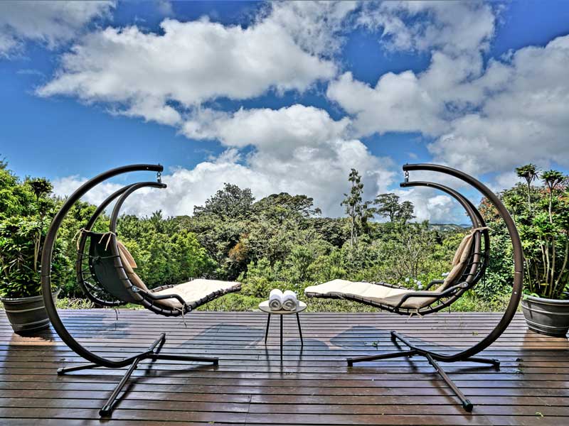
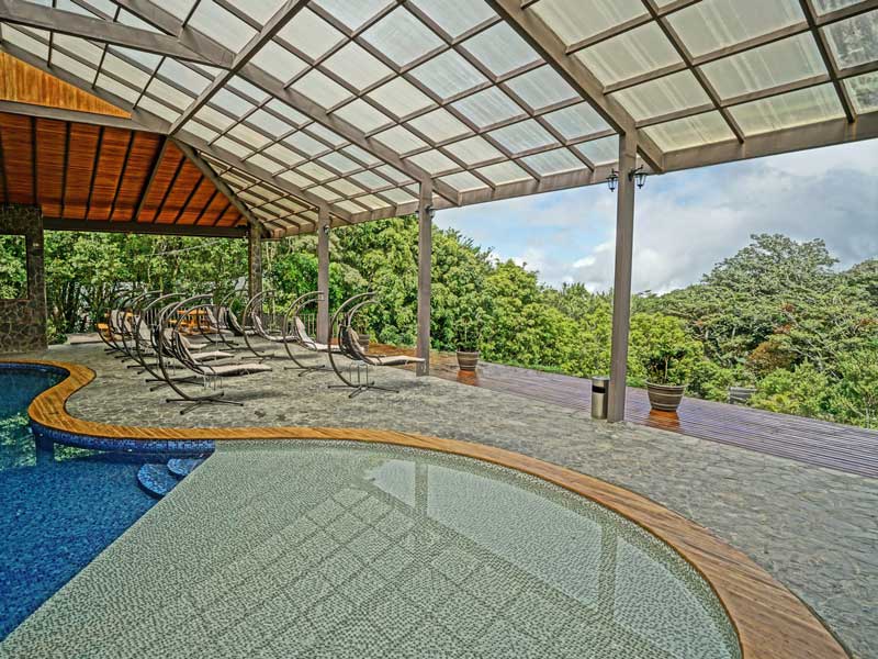
Day 2: Nanmbú Hotel, Carilllo

Located in beautiful and unspoiled Playa Carrillo, Nanmbú Hotel offers first class service and accommodation along with a high concern in the natural environment conservation, as they work to preserve the biodiversity in Costa Rica’s ecosystem.

Day 3: Dolphin Tour

The dolphin boat tour will coast into the Pacific Ocean, off shore of Samara beach. This thrilling experience will allow for all those onboard to catch a glimpse of the unique marine life and provide the opportunity for kids to catch local fish that they may bring back home. Amenities such as fresh fruits and water will be provided for all passengers. This opportunity also allows one to adventure into the ocean and watch dolphins in their natural habitat.

Day 4: Puerto Carillo

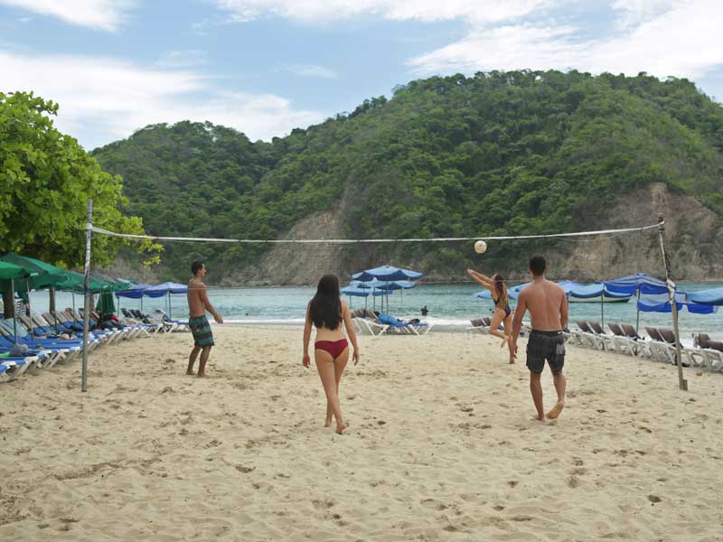
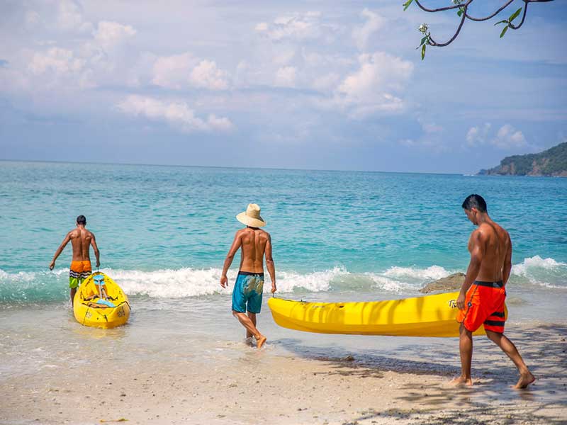
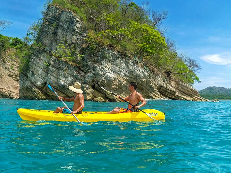
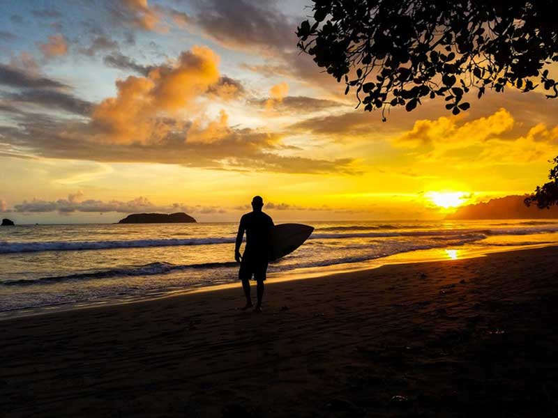
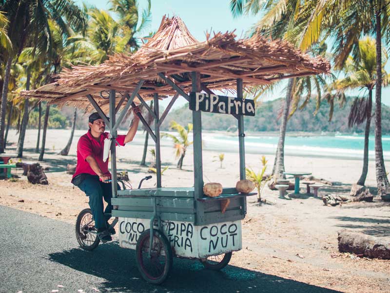
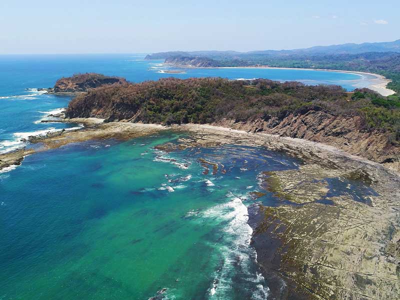
Explore the coastal hidden gem that is Puerto Carillo, with a variety of activities suitable for everyone including hiking, yoga, surfing, horseback riding, sport fishing and more. Spend your day at Playa Carrillo, a favorite local beach in Guanacaste due to the quiet rural atmosphere perfect for a serene and relaxing day under the sun. There, guests will find a sheltered cove with the utmost crystal clear water as the main roads run along the beach. Whether you’re laying under a palm tree or swimming among the gentle waves, you will see why Costa Ricans love Playa Carillo.

Day 5: Pick up at Nammbú Transfer to Monteverde

Day 6: MONTEVERDE

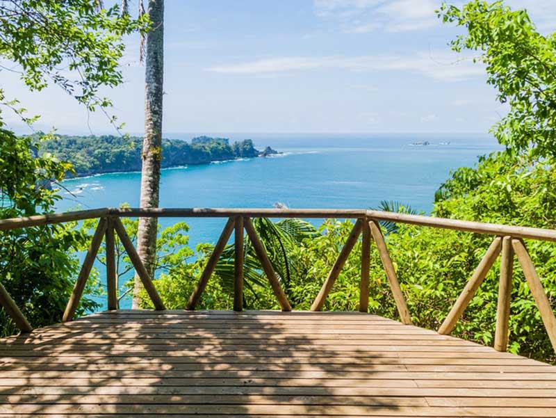
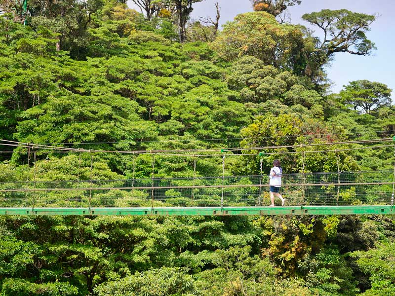
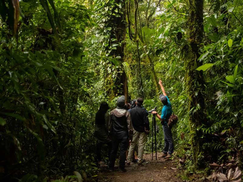
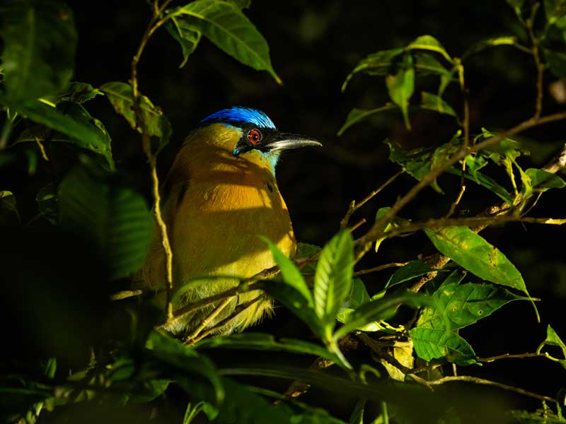
Home to one of the world’s most incredible Cloud Forests is Monteverde, located in the high mountains of the Puntarenas province. From a stunning range of plants and animals, Monteverde has a variable climate which has helped produce an extremely high biodiversity. Acclaimed as one of the most outstanding wildlife sanctuaries in the world and family-friendly reputation, visitors have an abundance of options to choose from when spending their time in Monteverde. The country’s best canopy tours and guided night walks are found here. Guests will have the opportunity to experience the richness of the area's biodiversity, exploring the cloud forest, waterfalls and its exhilarating heights, and ultimately learning about this wonderful destination.

Day 7: Pick up at El Establo Hotel Transfer to Hilton Garden Liberia

Day 8: Departure from Liberia Airport (LIR)

Itinerary Travel Partners:

ITINERARY: KIM SMITH

Central and South Pacific Coast: San Jose - Tortuguero

Day 1 : Arrival

Arrive in San José

Day 2 : San Jose → La Fortuna

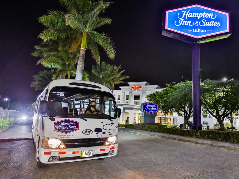
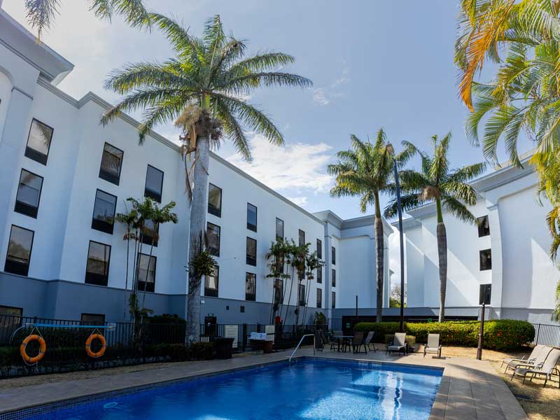
Transfer from Hampton Inn Suite, San Jose to La Fortuna.

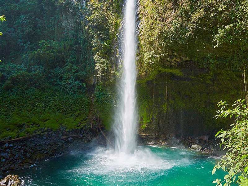
Day 3 : La Fortuna Waterfall

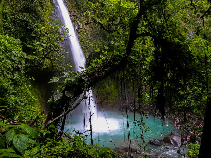
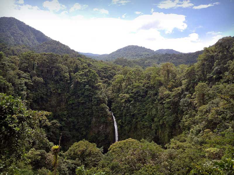
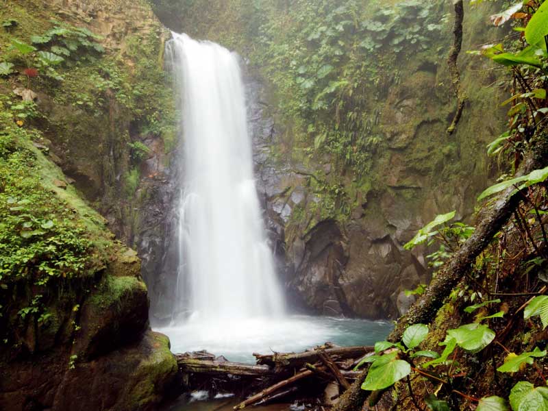
Set just outside the town of La Fortuna, this 230-ft waterfall is a great place to picnic, swim or take photographs. The fall runs through the pasture and rainforest, offering numerous chances to spot toucans, monkeys, and other tropical creatures where numerous species reside. Fed by the Arenal River, this most visited waterfall travels through the rainforest before plummeting into a jade-colored pool, attracting roughly 300-400 people a day. Although no one is allowed to swim in the water due to falling rocks, the stream can be viewed from two observation platforms.

Day 4: La Fortuna

Day 5 : Hot Springs

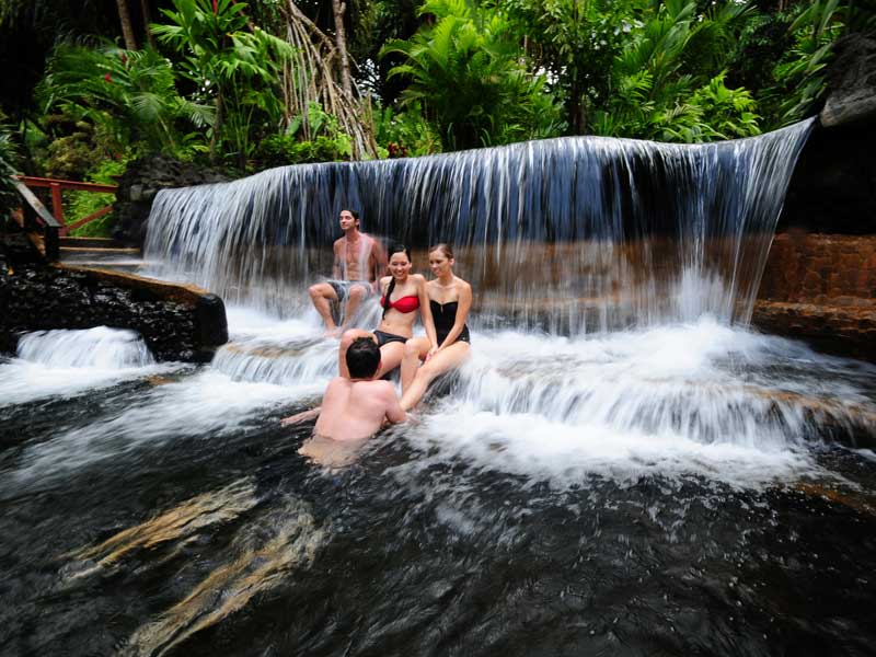
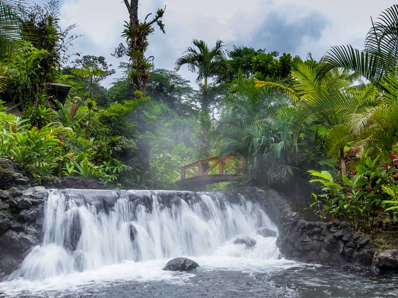
Costa Rica’s hot springs are a wonderful introduction to the relaxation and rejuvenation found in this tropical splendor. The mineral-laden waters of the hot springs in Costa Rica have been used for therapeutic reasons for over 200 years, treating a variety of aches and pains. The hot waters from the Arenal Volcano provide an enriching and relaxing experience as this noteworthy pool is rich in minerals associated with health. Guests can relax in one of the many hot springs La Fortuna has to offer, while enjoying the natural landscape in the rainforest.

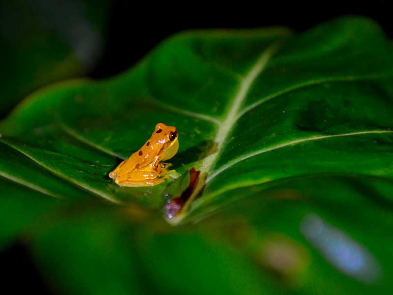
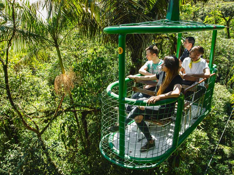
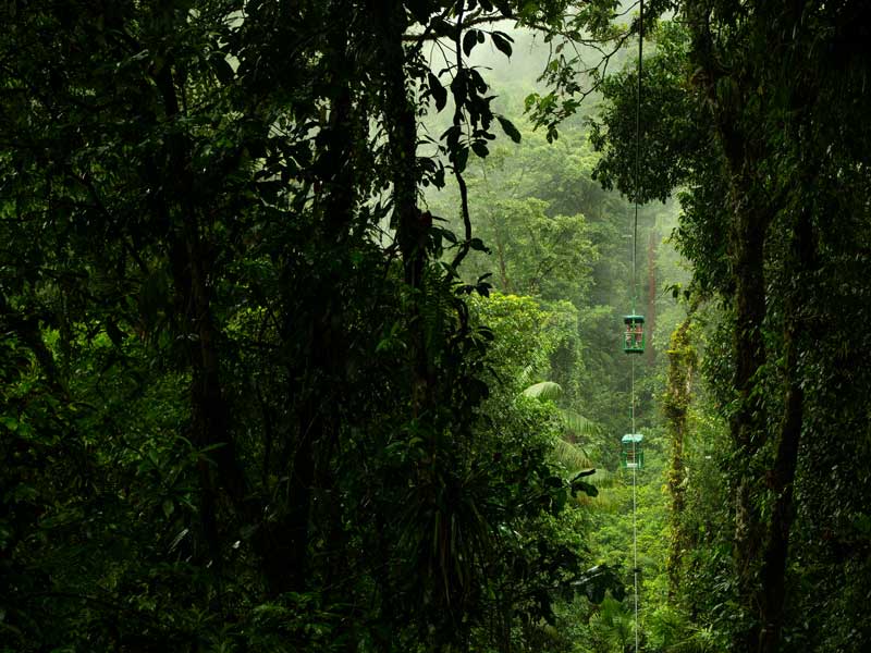
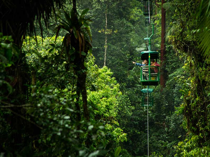
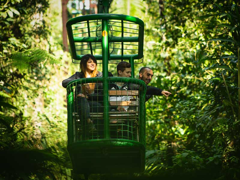
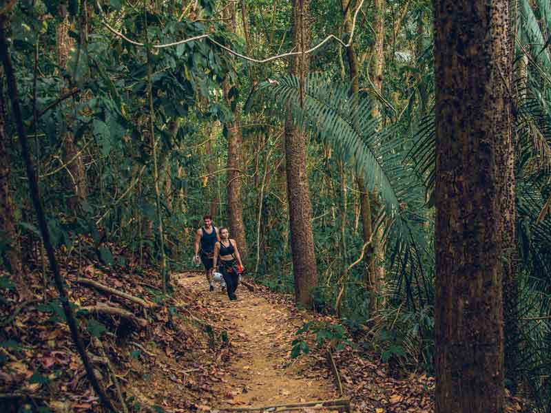
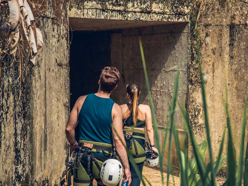
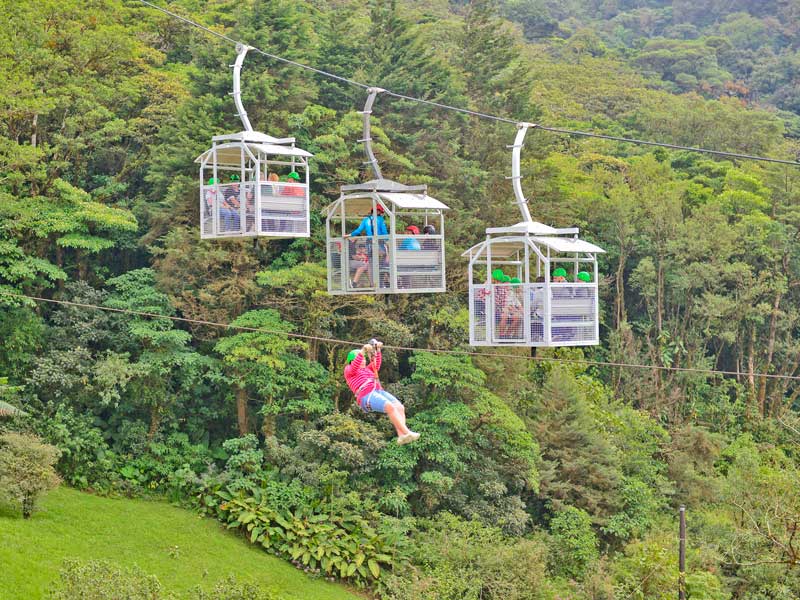
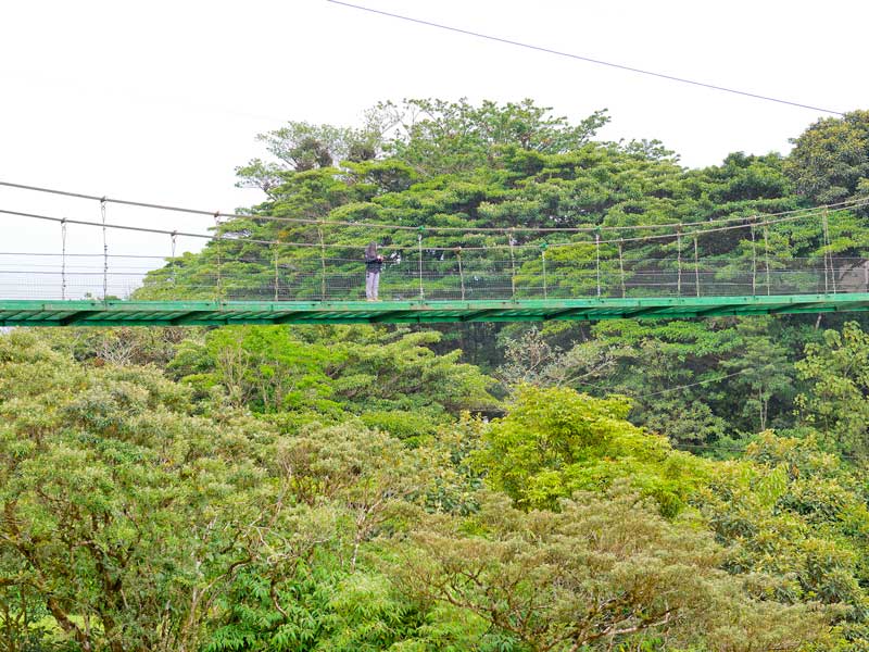
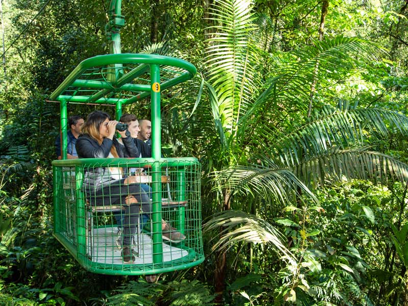
Day 6 : Braulio Carrillo National Park, Aerial Tramp Tour (Rainforest Adventure)

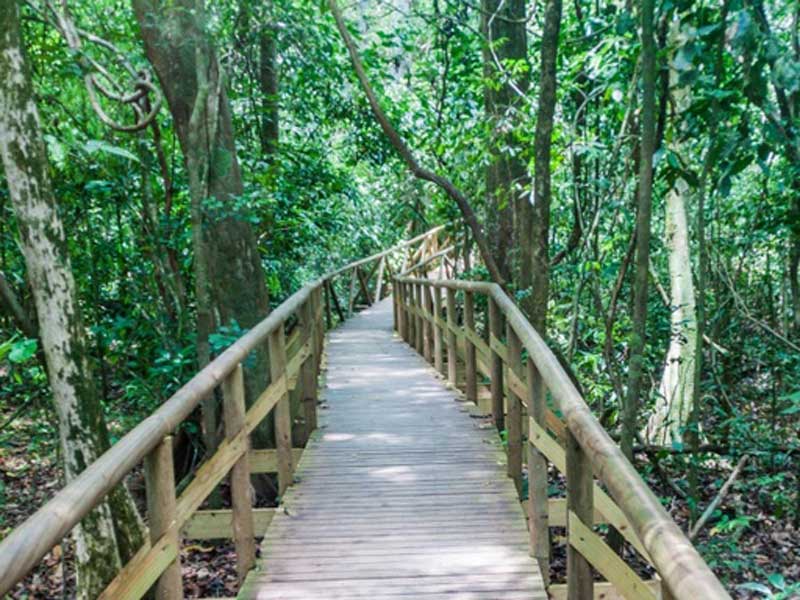
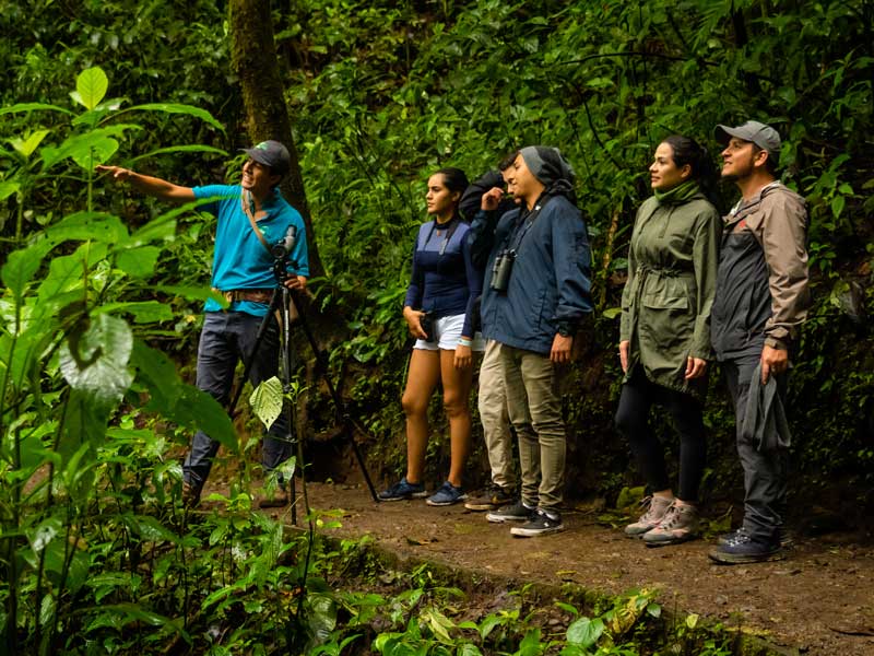
Explore three levels of lush Costa Rican rain forest from the floor to the canopy on a guided tour of Braulio Carrillo National Park. Learn about local flora and fauna as you walk along nature trails, explore specialty gardens, and glide over treetops in an aerial tram, all narrated by a guide with extensive knowledge about the local ecosystem.

Day 7: La Fortuna

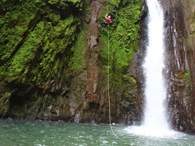
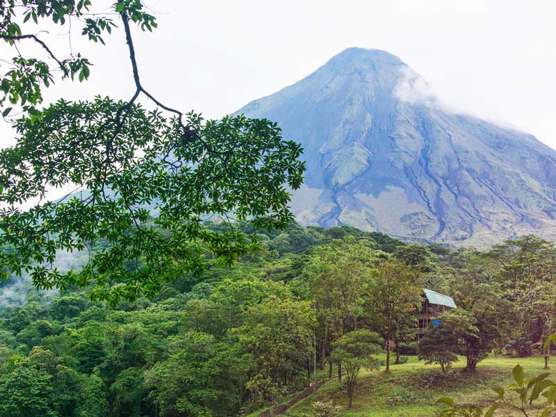
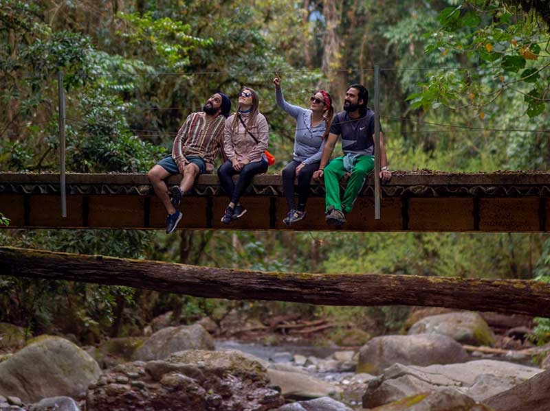
Dominated by Arenal is the small, agricultural town of La Fortuna. Most days, the public can view the volcano’s massive cone that towers over the town and the western horizon. Other activities such as canyoning and whitewater rafting can also be found in La Fortuna that offer an adrenaline-soaked adventure down the rivers. Formed from the union of two rivers with different mineral content from the slopes of the Tenorio Volcano is the beautiful Celeste River. The waters of this river portray an intense blue color which trails through the hot springs, waterfall and fumaroles. Other notable water activities include the Arenal Lagoon, the country’s largest artificial lake, and Bajos del Toro Amarillo Waterfalls, a unique landscape with blends of rivers, waterfalls, hydroelectric projects, natural reserves and agricultural landscapes. For thrill seekers, visitors can discover the hidden gems in the rainforest as they trail along the hanging bridges with views of treetops, wildlife sanctuaries, and high density of biodiversity.

Day 8 : Departure from San Jose

Depart from Juan Santamaria International Airport (SJO)

Itinerary Travel Partners:

Costa Rica’s Pura Vida lifestyle, and the understanding of what is essential in life, was the core focus of the travel marketing campaign “Life’s Essentials Found Here.”

The protected area of Corcovado encompasses 41,788 ha of shallow lakes, swamps, mangroves, rivers, lowland rainforests and cloud forests, as well as 46 km of sandy coastline. It is one of the most unique ecosystems in Central America, welcoming naturalists who come from around the world to study it. Its extensive territory allows visitors to observe the biodiversity of one of the last truly untouched areas of Central America. The park is home to 6,000 insect species, 500 tree species, 367 bird species, 140 species of mammals, 117 species of amphibians and reptiles, and 40 species of freshwater fish.

The park has several trails for hikers and rustic refuges for camping. All visitors must enter with an authorized guide. Less adventurous visitors can also enjoy the park on boat trips through its waterways, or fly into Sirena Station. Keep your eyes open: whales and parrots are just some of the animals you can see in Corcovado. Indeed, visitors can see many endangered animal species here. The park services include information, a park ranger station, a landing strip, trails, signage, restrooms, drinking water, camping area, radio communications and rustic accommodations.


A sign in front of a lush green forest.


  • Area: 42,400 ha.
  • Hours of operation: Every day from 7:00 a.m. to 4:00 p.m.
  • Telephone: +506 2735-5036
  • Directions: 

    SECTOR LEONA: From San José, take the Pan-American Highway (called the Interamericana in Costa Rica) towards Piedras Blancas, turning right at La Chacarita Service Station towards Puerto Jiménez. Continue to Carate, taking special care during the rainy season as you will have to cross several rivers, which can only be done in 4x4 vehicles. The destination is approximately 395 km from San José.


An animal standing on top of a pile of dry grass.


SECTOR SAN PEDRILLO: From San José, take the Interamericana towards Pedras Blancas, turning right at La Chacarita Service Station and continuing until Rincón. There, turn right until you reach Bahía Drake. You can also take the exit for Sierpe and, from there, take a boat to Bahía Drake. The destination is approximately 395 km from San José.

SECTOR LOS PATOS: From San José, take the Interamericana towards Piedras Blancas, turning right at La Chacarita Service Station and then right again until La Palma. From there, continue to Los Patos Station. Only accessible with 4x4 vehicles during the dry season, since there are several fords of the Río Rincón. During the rainy season, access only possible on foot along the river from Guadalupe. The destination is approximately 395 km from San José.

SECTOR SIRENA: From San José, take the Interamericana towards Pedras Blancas, turning right at La Chacarita Service Station and then right again until Puerto Jiménez. You can also take the exit for Sierpe and, from there, take a boat to Bahía Drake. The destination is approximately 395 km from San José.


The protected area of Corcovado encompasses 41,788 ha of shallow lakes, swamps, mangroves, rivers, lowland rainforests and cloud forests, as well as 46 km of sandy coastline. It is one of the most unique ecosystems in Central America, welcoming naturalists who come from around the world to study it.

A festive environment!

If you’re looking for an option with sun, catamaran rides and a great ambiance, you have to visit this natural spot.
Beautiful Isla Tortuga is located off the southeastern coast of the Nicoya Peninsula and is only accessible by boat. Several companies can bring you here from different parts of the country, so there is no excuse not to visit the paradise of white sand, turquoise waters and beach chairs that awaits you.

It is important to know that only day tours are available, since hotel accommodations are not available on the island. This helps preserve the attractions of the location, the perfect combination between flora, fauna and sea.

You can reserve the tour from Jacó, the Curú Wildlife Refuge or in the area around Montezuma.
One of the best known points of departure is the Puntarenas port. The trip from Puntarenas can take about an hour and a half, with departures beginning at 7:30 a.m. and return trips at 4:00 p.m. (after which no one is allowed to stay on the island) for a return to Puntarenas by 6:00 p.m.

A group of people playing volleyball on a beach.

An island for every style

Isla Tortuga offers delights for every taste, whether you wish to spend the day relaxing or you’d like to opt for activities like snorkeling, kayaking, horseback riding tours, nature hikes and even more specialized activities and sports like jet ski, banana boat and paddleboarding. Other activities that await include beach volleyball or a sandy pick-up soccer match, or mejenga.

Traveling to this tropical island is such an adventure, especially with the catamaran ride that allows you to fully enjoy the trip there and back. For some years now, companies have been offering all-inclusive tours that include transportation, meals, live music on the catamaran and tours, meaning you don’t have to worry about a thing.

Remember to bring back some photographs of the island’s vegetation and the incredible sunset over the Pacific on your way back. We know that once you get to explore this paradise, you’ll be organizing your next trip back before you’re off the boat.

A woman laying on the beach reading a book.

Information you need to know

  • Information about the island: Isla Tortuga actually consists of two very small islands right next to one another, called Alcatraz (60 ha) and Tolinga (120 ha).
  • How to get there: Drive to the Puntarenas ferry docks (1 hour and 40 minutes from San José on Route 27).
  • Sand: white
  • Water: aquamarine
  • Sea life: dolphins and whales can often be spotted.
  • Access: by catamaran or ship.
  • Accommodations on the island: none
  • Departure and return times: 7:30 a.m. a 4:00 p.m.
  • Activities: jet ski, banana boat, paddleboard, kayak, snorkel, hiking, and beach chairs for rent.
If you’re looking for an option with sun, catamaran rides and a great ambiance, you have to visit this natural spot.

A hidden sanctuary

If your answer is yes, we know you can’t wait to get back, and if not, we’ll give you that little push you need to take the plunge.
Visiting this beach is like stepping into the pages of a travel magazine: its white sand and aquamarine water will remain in your memory forever.
Located on the Nicoya Peninsula, it is part of the Curú Wildlife Refuge, meaning that you’ll have to cross this protected area to see the beach for yourself.
Are you just looking for some time with your partner or friends? Do you want to practice kayaking? What about snorkeling? Or maybe hiking? If you answered yes to any of these questions, head to Quesera – all of these activities are possible here.
Its magical crystalline water reflects the sea floor, while dozens of palm trees provide you with shade while you enjoy some ‘you time’.
Don't forget to find your best spot to be ready when the sun goes down, since the sunsets here are to die for.


A group of people on a beach with a yellow surfboard.

Just opposite the coast, you’ll be able to see Isla Tortuga, which, by the way, is another tour to think about when you’re in the area.
The nature sanctuary has 1,496 hectares of tropical forest with mangroves and fields up and down the coast.
It is also home to a wide variety of flora and fauna. Specialists have identified 78 species of mammals, 232 different kinds of birds, 87 reptile species and over 500 species of plants.

How do I get there?

To reach Quesera, you’ll first have to enter through the refuge. You can opt for a boat tour that will last about 20 minutes, or you can do it on a trail that takes about 2 hours (though it could be less depending on each person’s physical condition), or by kayak if you prefer.
The trails are low difficulty, making them an ideal way to take in the biodiversity that this incredible place provides us.
Quesera is definitely one of the best beaches Costa Rica has to offer. But it’s one of many excellent options in every corner of our coasts – cross one off your list of destinations today!


A couple of people that are in a kayak.

Everything you need to know:

  • How do we get there? Drive to Puntarenas (1h 40min on Route 27), then take the ferry to Paquera (1h 30 min). Once you’re in Paquera, drive 30 min to Curú (the entrance will be on the left).
  • Road quality: the road from Paquera to the refuge is constantly being improved, meaning you can go in any kind of vehicle.
  • Entry fee at the refuge: ₡2,500 for Costa Rican citizens and residents / $13 for foreigners.
  • Hours of operation: for individual visits, from 7:00 a.m. to 4:00 p.m. However, those who are lodged in the refuge’s cabins can stay longer and even enjoy nighttime tours and hikes.
  • Services: showers, bathrooms, restaurant, security guard and rental cabins.
  • Tours provided: horseback rides, kayaking, diving, snorkeling, tours to Isla Tortuga, bioluminescence tours, wildlife observation.
  • Average rates: Tours cost between $15-$35 per person, depending on the company and the time of year.
Visiting this beach is like stepping into the pages of a travel magazine: its white sand and aquamarine water will remain in your memory forever.


1. Location and amenities: The city is located 3 hours from San José, just 165 km along the highway. The area is renowned throughout the country and internationally for its sport fishing, with species including marlin, snapper, greater amberjack, wahoo, dolphinfish, yellowfin tuna and roosterfish, among others. The beautiful canton has a great variety of open-air attractions, restaurants, bars, hotels, shops, galleries and spectacular beaches. On your way for a visit, you can also stop in at Atenas, Orotina, Tárcoles and Playa Jacó.

2. Whale watching: Yet another attraction in the area are the giants of the Pacific, humpback whales. Every July, they delight tourists as they come to the region, staying until November. You don’t have to go very far to witness the exuberance of nature. Strategically located in Costa Rica’s Central Pacific, Quepos has the tourism infrastructure in place for amazing whale and dolphin watching.

3. Beaches and mountains: Quepos has a wealth of opportunities to explore, from its beautiful seafront to the adrenaline-pumping activities on offer all around the town. Before coming to Quepos, you can enjoy recreational fishing in tilapia farms or spend some family leisure time at a local water park. The village of Londres offers a strategic point to enjoy a horseback ride and explore its dense forests. If beaches are more your style, there are many near the Manuel Antonio National Park, just waiting to be discovered. These include Cocal, La Macha, La Vaca, Pará, Biesanz, Playitas, Las Gemelas, Del Rey, Savegre, Matapalo and Linda. The activities on offer include kayaking, surfing, sport fishing, rafting, catamaran tours, horseback tours to waterfalls, day- and nighttime hikes, visits to mangroves and observing the plant and animal life.

4. Cuisine: Quepos is a hidden treasure of delicacies that will have you licking your fingers. Many are traditional dishes from the Pacific coast. If you visit the region, you may encounter dishes like ceviche made from clams or piangua (a mollusk with a black shell, abundant in the mangroves of Quepos), as well as better-known ceviche options made with fish or shrimp. The delicious casados, meals featuring rice, beans and meat, always include vegetable sides called picadillos, which may be made from green papaya, potato or chiquasquil, a tree leaf with a spinach-like taste. If you haven’t tried a garlicky dolphinfish fillet or a whole fried snapper, you know what to ask for on your next culinary detour.

A plate of food on a wooden table.

5. Capture the best moments: When you leave, you’ll take plenty of magical moments spent with your family or friends. Quepos has the perfect spot for you to take the perfect vacation photo.

  • Paradero Nahomi: just 200 m from the Quepos pier, it’s a hidden gem. Towards the south, you can take in the city of Puerto Quepos, along with Bahía Maracas to the east and the Pacific Ocean to the west. This is the perfect spot to take in the sunset.
  • El Malecón: one of the canton’s iconic spots, a 450 m stretch with three perfect photo angles that can’t be missed: one in front of the giant Quepos sign, another with the Pacific Ocean behind you, and another with the Quepos Marina as a backdrop.
  • Punta Catedral: located within Manuel Antonio National Park, the panoramic lookout used to be an island, but is now connected to the continental mass by a sandy stretch. The spot offers impressive views surrounded by lush vegetation.
  • Catarata Portalón: located 30 minutes south of Quepos, it is one of the most beautiful waterfalls in the canton. It’s the perfect place to spend a day with your family or friends and enjoy a refreshing swim.
  • Playa Linda: located just 30 minutes from Quepos, also towards the south. In addition, it is located between Playa Matapalo and Dominical, two more beautiful beaches you can enjoy. The beach is an excellent option for picnics or a memorable photo session.

What’s keeping you from checking these destinations off your list?


Costa Rica isn’t hurting for visitors, and with all those fellow travelers on the road, you might expect it to be difficult to get off the beaten path. But consider this: Costa Rica is home to a full 6% of the world’s biodiversity and counting.

The Caribbean keeps surprising us every time we visit it, so we asked locals to help us out by recommending places that may not be particularly well-known or popular among vacationers, but which offer intriguing scenery and are worth exploring.
So, take a look at this list and check them off on your next trip to the Caribbean.

Are you game?

1. Playa Bonita

Located 10 minutes outside of downtown Limón. It is known for its golden sand, strong waves and having few stones. This is a sought-after beach among surfers due to its waves, but it’s also a perfect spot for those looking to relax and work on their tan. You can find a variety of restaurants and lodgings near the beach with a view of the sea – perfect for a well-deserved holiday.

2. Playa Piuta

Located less than 4 km from downtown Limón. It is a good place to go with your family, since the sea is peaceful here. Here, you can enjoy Caribbean food with a side of sea breezes.

3. La Poza de Playa Bonita

Just behind Playa Bonita is an idyllic, hidden spot. The pool here is visited more by locals than by the tourists who come to the beach. You’ll reach here by heading along the coast until you reach a path that quickly becomes full of coral. We recommend that you go with someone who knows the area.

4. Isla Quiribrí or Isla Uvita

Popularly known as Isla Uvita, the region’s indigenous people named it Isla Quiribrí, which is now its name thanks to a decree of the Legislative Assembly. Earlier, Christopher Columbus had named it “La Huerta”. A 1985 decree designated it as a National Monument, which ranks it as Historic Architectural Heritage of Costa Rica. This island was the first part of Costa Rican territory where Christopher Columbus set foot on his fourth trip to the Americas, which is why it is of such historic interest for visitors. Go ahead and take a trip to Isla Uvita and enjoy its turquoise waters, biodiversity and natural surroundings that are typical of the Caribbean.

5. Catarata Volio and Bribri:

On the southern Caribbean coast are two enchanting waterfalls, perfect examples of what the region has to offer aside from the heat of its beaches. These two waterfalls are surrounded by nature and located less than 6 km from Bribri. We recommend that you use a 4x4 vehicle, since the road is unpaved and a bit rough in places. In addition, take a change of clothing and shoes, since you’ll have to pass through rivers before reaching the waterfalls.

6. Cacao tour

A tour rich with nature and discoveries awaits in the Talamanca region. Catato López’s medicinal plants and chocolate tour takes place in the Watsi Reserve, 3 km from Bribri. In addition, you can visit the frog sanctuary he keeps on his farm and learn about the history of his ancestors. Try the “miracle fruit” when you take the tour – you’ll find out what we mean.

Unique cuisine, mountains, beaches, history, unforgettable sunsets: the Caribbean awaits with its wonderful people and places. The Caribbean has plenty to offer, hurry up and find out for yourself!

We've asked locals to recommend places that may not be particularly well-known or popular among vacationers in the Caribbean area.

We went to Costa Rica’s southern Pacific region and wanted to see its natural surroundings. Have you ever visited the Hacienda Barú National Wildlife Reserve?

The opportunity to explore its trails is one that simply can’t be missed. While we were on the trails we saw so many species of animals: monkeys, sloths, birds… it was quite the experience, and we can’t wait to tell you more.

Protected natural area:

To begin with, you should know that this reserve is comprised of some 330 hectares of protected areas with primary and secondary tropical rainforest, wetlands, mangroves and coast (3 km of beach and 1 km that borders the mouth of Río Barú).

In addition, it is part of the Paso de la Danta Biological Corridor, which spans from the Río Savegre watershed to that of Río Terraba-Sierpe.

We were told that in June 2017, UNESCO declared Savegre to be a Biosphere Reserve (this includes land that encompasses the Hacienda Barú National Wildlife Reserve and includes the Río Savegre watershed). This is because the region is home to 20% of Costa Rica’s flora, as well as 54% of its mammals and 59% of birds.

Hacienda Barú also supports ASANA (www.asanacr.org), a non-profit association whose vision is to maintain and improve the biodiversity and connectivity of the Paso de la Danta Biological Corridor and the natural areas it connects. They are involved in various projects that have resulted in major advances in the protection of vulnerable species that live inside the Wildlife Reserve.

A woman looking through a pair of binoculars.

Wildlife passages: When the Costanera Sur highway was paved, the first system of wildlife passages was installed, which animals such as peccaries, raccoons, wild cats and monkeys use to cross the highway without the danger of being hit by vehicles.

These passageways consist of drainage ditches, square tunnels and elevated bridges throughout the segment that crosses between the refuge’s mountainous and lowland areas.

Camera traps: The camera trap networks that has been installed in the forest has allowed species such as the ocelot, jaguarundi and peccary to be monitored. The videos permit the behavior of these species to be studied, so that we can learn more about them.

Turtles: This project consists f protecting the eggs laid by the sea turtles who nest on the nearby beaches and keep them safe from predators and poachers. Once the baby turtles are born and ready, they are set free to begin their adventure in the ocean.

Environmental education: The Biological Center seeks to promote environmental education in the community. They do this through activities such as talks or guided visits to the Wildlife Reserve.

A group of people hiking through a forest.

Research center

The Hacienda Barú Biological Research Center offers researchers and students the opportunity to stay in comfort and safety while carrying out their research or education or simply explore the trails of the Wildlife Reserve.

The center began operations in 2012 with the main objective of improving the conservation and restoration of the ecosystems in Hacienda Barú Wildlife Reserve and the neighboring areas. In addition, it seeks to promote the expansion of scientific knowledge about wildlife and the social context with a long-term vision while providing accommodations and other valuable experiences to researchers and students in relevant areas.

On arrival, you will see two buildings, each of which have eight rooms with a maximum capacity of 40 people. The beds are mostly bunk beds and the restrooms are spacious and comfortable. It also has a laboratory (392 m2), a classroom that seats 30 people, a dining area for 40 people as well as Wi-Fi and parking.

If you are interested in learning more about the species that are studied at the center and those present in Hacienda Barú Wildlife Area, check http://haciendabaru.org/especies/

A man and a woman walking out of a cave.

Trails

The day we arrived we went to see the facilities and then try hiking through the trails of the Wildlife Refuge. The guides kindly gave us a quick introduction to the histroy of Hacienda Barú and its importance in the process of recovering the natural wealth of the region. It is important to mention that the land used to be pasture or agricultural land.

We hadn’t advanced even 100 meters before we saw an adult sloth taking a nap in one of the ceiba trees. It was just his way of welcoming us! A little further ahead, we reached a small cocoa plantation located on the edge of the Costanera Sur highway. Rigo, one of the two guides who was traveling with us, told us that the land used to be used for cocoa farming.

We went a little further along and when we got close to the highway, we found one of the tunnels and one of the bridges for monkeys or sloths, which were built to make it easier for fauna to travel from one part of the reserve to another without having to cross the road. The tunnels are really large, to the point that even we could cross them on foot.

Once we reached the other side, we saw different species of timber and fruit trees. We even saw a royal palm, a native species in Panama and Costa Rica that was used by natives to make their houses. It is also a protected species because of its fruits, which feed the animals in the Wildlife Refuge.

The tour is 2 km (1.3 miles) in total; there are also birdwatching and ziplining options. At the end of the trail, we found a group of white-faced capuchins who entertained us for a few minutes as they swung from tree to tree while we watched. They really put on a good show!

How to get there

You have to head down the Costanera Sur highway (route 34). The Hacienda Barú Biological Research Center is located 800 meters northwest of the bridge over Río Barú or the intersection with the highway between Dominical and San Isidro de Pérez Zeledón.

Have you ever visited the Hacienda Barú National Wildlife Reserve? The opportunity to explore its trails is one that simply can’t be missed.

This time around, our curiosity to see more of our country brought us to one of the largest districts, one that covers 80% of the total area of the Heredia province – we’re talking about Sarapiquí.

As soon as we were told about Don Leo Herra’s "Hormigas Town", we didn’t hesitate to find out for ourselves why it captures the attention of tourists visiting the area. So we got ready for our adventure with a fresh change of clothes, sunblock, and a good hat.
Leo, a 47-year-old father of three decided to leave his old job and dedicated himself to his passion: investigating the world of ants.

Leo began the pursuit of this dream in 2006, but it wasn’t until 2008 that the tour picked up momentum and gained popularity.
With training at the Organization for Tropical Studies (OTS), field observation in the forest, his own research, and of course looking things up on the Internet, Leo took about 2 years to learn more about these small insects.

A close up of a person holding a small insect.

Perfect for the whole family

This tour is highly recommended for the whole family and we don’t have the slightest doubt that the little ones will love it. Even we, the adults, found it jaw-dropping!

The day of the outing, the weather was spectacular and the warmth of this beautiful district didn’t leave our side for a single second. We were ready for the tour!

In about 1 hour we found out why ants don’t eat leaves, and why there can only be one queen in a colony.According to the people who told us about Leo, who also took on the role of tour leader, there are approximately 12,000 species of ants in the world, and about 600 ant species in Costa Rica.Ants also have the most members per colony out of all the insects.

In the "Hormigas Town" tour, you will see 3 established colonies that Leo designed in a very natural system that simulates what happens with these small insects in the forest. Usually they can travel 300 meters from where they collect their fuel (leaves) back to their colonies. Here on the tour, however, they only travel 80 meters. There is also a part at the beginning of their route called "El Súper" (“the supermarket”), which is where the ants get the raw material to make the fungus that they eat. You didn’t misread! If you thought that the ants ate leaves, you’ve been living a lie. The leaves are just the raw material that allows them to cultivate the fungus that is seen in the colonies. Certain worker ants are in charge of making food for the other ants by using leaves and their saliva.

A man standing next to a wooden box.

Colonies can have up to 6 million ants

These insects have very important missions to accomplish. The worker ants mentioned above are the ones that cultivate the fungus for their food. Another group of worker ants are the ones in charge of getting the leaves. A third group of worker ants act as soldiers protecting the queen. They stand guard, looking out for intruders from other anthills. It’s also worth mentioning that they have Herculean strength, capable of carrying 300 to 400 times their own weight!What’s more, the queen plays such an important role for her colony that if she dies, her entire colony will perish too. We’re talking about a colony that can have 5 to 6 million ants within 5 years of being established - impressive!

While we toured the facilities containing the city of ants, Don Leo explained that once a year, a miracle of nature happens: "the nuptial flight", in which the queen is fertilized by the male. This provides her with millions of sperm so that she can lay eggs throughout her entire life. Once the male succeeds in his mission, he dies.

There’s no doubt that we learned a lot, and we know that you’ll enjoy it as much as we did. And if you have a niggling curiosity about how this queen is doing, there’s only one way to find out - traveling to Sarapiquí. Don Leo will surprise you with more interesting facts about these little friends.

The tour takes place within the property of Aguas Bravas Rafting, one of the companies affiliated with Vamos A Turistear, so you can take the opportunity to go on adventure tours too.

Aguas Bravas is located in the town of Chilamate, about 10 minutes from the intersection of Puerto Viejo de Sarapiquí. At Aguas Bravas, you can enjoy tours such as: the very popular rafting, Canopy Zipline Tour, Night Safari, Safari Float, Sarapiqui a la Carta, Sarapiqui a la Carta Plus, Eco Rafting on the Sarapiquí River, horseback riding and you’ll find accommodations too. They also have a new experience that’s now available to the public – a special rural tourism offer. They definitely have everything you need to have an incredible weekend surrounded by the purity of nature.

This time around, our curiosity to see more of our country brought us to one of the largest districts, one that covers 80% of the total area of the Heredia province – we’re talking about Sarapiquí.

If hiking is your thing, Manuel Antonio National Park has 6 different options for you to enjoy one of the country’s most visited parks.

It is important to underline that, as of February of this year, it has an elevated metal boardwalk that is 2.42 meters wide, designed so as to avoid impeding the passage of animals who live in the surrounding habitat.

It also has a railing designed for persons with disabilities, as well as children and seniors. In addition, the signage is also written in braille.

A man holding a surfboard while standing on a beach.

Find out about the main attractions:

  • Trail: La Catarata The trailhead is 200 meters from the park entrance. The trail is 900 meters long and, as its name suggests, it leads to a small waterfall (catarata in Spanish). You will see some frogs along the way, if you look closely.
  • Trail: El Perezoso This is one of the shortest trails: all visitors can enjoy it, as it runs parallel to the park’s main trail, along which visitors head to the various beaches and common areas, including showers and restrooms. This scenic trail is favored by many of the park’s sloths, and is accessible to the general public.
  • Trail: Punta Catedral In addition to the park’s wonderful beaches, Punta Catedral is one of the most iconic parts of the park. It is 1.4 km long and takes about one hour to do the full tour. The site has several lookouts that allow you to enjoy spectacular views. The trailheads are located at the ends of the Espadilla Norte and Espadilla Sur beaches, which it connects. Punta Catedral is a favorite among both locals and foreign tourists.
  • Trail: Playa Gemelas This short trail will take you to Playa Gemelas, and connects to the other trails in the western portion of the park. If you visit this trail during low tide, you will have the opportunity to enjoy a unique view of Punta Catedral.
  • Trail: Mirador 1.3 kilometers in length, this trail will lead you to a gorgeous lookout from where you will be able to observe the majestic beauty of Punta Serrucho, a landmark that has been given a sawtooth appearance due to numerous tectonic movements.
  • Congo Trail: This short trail connects Playa Gemelas and the Mirador Trail; it can be used as an alternative return route.

Advice:

  • Take plenty of water if you plan on going down more than one trail.
  • Don’t forget to take sunscreen, a hat to protect you from the sun, and insect repellent to guard against hungry mosquitoes.
  • If you plan on exploring all of the trails, we recommend that you leave nice and early, as the park closes the trails at 4:00 p.m.
  • Don’t leave the trails.

A wooden deck with a view of the ocean.

Recommendations:

  • The manchineel tree, locally known as manzanillo, is toxic: do not sit underneath it or eat (or even touch) its fruits.
  • Enjoy nature the right way: do not touch wild plants or animals, do not collect shells.
  • We invite you to experience a walk through the woods using the extensive trail network and the lookouts located in the park’s highest points, at around 160 meters above sea level. These lookouts allow you to appreciate the scenic beauty of the coast and the vegetation located in the more distant sectors of the park.
  • The use of appropriate footwear is recommended while walking on the forest paths. Sandals are not recommended. Try not to make noise, do not leave the public areas and do not climb on railings or signs.
  • Take care of your belongings at all times and try not to carry food that attracts wildlife. Remember that feeding wild animals is not allowed. Some products may have a serious impact on their health and lead to changes in their behavior.
  • Do not interact with the animals. Keep your distance and do not leave food within their reach.
  • Help keep the area clean. Do not leave trash or any traces of your visit.
  • The park sees fewer visitors during the months of September and October, since this is the peak of the rainy season. If you visit during this time, it is recommended to visit early in the day and use suitable clothing.
  • It is important to remember that this park does not have vehicle parking and the only road between Quepos and Manuel Antonio has very heavy traffic during the peak season.
  • The park rangers only work inside the park and their uniform bears the logos of the national park system, SINAC. Always remember that you can ask them for information if you need.
  • The main entrance station has feedback forms where you can leave your opinion about the park.

A wooden walkway in the middle of a forest.

It is important to note that the following are NOT allowed:

  • Entering with food and/or drinks of any kind under the conditions and with exceptions set out by the park administration.
  • Feeding wildlife.
  • Entering with pets of any kind.
  • Damaging the infrastructure, plant life, animals and other items in the area.
  • Taking away firewood or building fires.
  • Carrying weapons.
  • Causing disturbances, behaving improperly or smoking, consuming liquor or drugs.
  • Posting advertisements of any kind.
  • Fishing or hunting.
  • Beach umbrellas, beach balls, tents and hammocks are not allowed.
If hiking is your thing, Manuel Antonio National Park has 6 different options for you to enjoy one of the country’s most visited parks.

We had been planning on going to check out Dota, located towards our country’s southern region. Finally, things were coming together! The summery climate was an invitation to pack our bags and begin the journey to the village of San Gerardo, a place bursting with natural beauty.
We left downtown San José nice and early with our jackets in hand, bracing ourselves for the famously cold climate of Cerro de la Muerte, which we would pass on our way. As we progressed on the route, landscapes began to appear around us, including the towers of the Los Santos wind park. Then, we stopped for the mandatory breakfast en route and kept going towards San Gerardo.

Escape the daily grind

Dota is the 17th canton of San José province, which forms the Los Santos Region alongside the cantons of León Cortés and Tarrazú. It has an area of around 400 km2, which makes it the fourth-largest canton of San José, and is divided into 3 districts: Santa María (its main district), Jardín and Copey.
If you want to get away from the rat race, San Gerardo de Dota is one of the best places to do so. It’s a place full of natural beauty and hard-working people, where you can watch birds, enjoy rivers full of crystal-clear water and cascades, trout fishing, trails through the cloud forest, and visits to the Los Quetzales National Park - there are so many activities that await you.
San Gerardo is a community bordering the Los Quetzales National Park located at 2,200 meters above sea level, hidden in the folds of the Río Savegre Valley.

A group of people sitting on a bridge over a river.

Observing quetzales

The quetzal’s exotic beauty makes it one of the most iconic birds in the world. San Gerardo offers opportunities to see them, since the cloud forest is the bird’s ideal habitat and the source of its preferred food, the fruit of the aguacatillo tree. Its nesting season is between the months of April and May, which means that it is easier to see them in this region of the country during this time of year.

Hiking on the mountain

If you love hiking, plenty of routes crisscross the forest and allow you to admire the many ecosystems that this part of the country has to offer. You’ll find gorgeous places to take photos and sit down to enjoy the sounds of nature. Don’t forget to bring something to protect yourself from the cool rain, since the climate tends to stay at a cool 13-18°C depending on the time of year you visit. Take something to eat and to keep yourself hydrated, but remember not to leave any garbage.

Río Savegre: trout fishing

This community extends along the banks of the Río Savegre, whose clear water is usually bracingly cold Caves and cascades can be seen throughout the river’s course. If you enjoy fishing, you’ll find delicious trout abounding in this river. Keep in mind that the fly-fishing season is from May to June and the bait-fishing season from December to March. Most restaurants in the area have menus that feature this fish in a variety of dishes. You'll enjoy trying our every different recipe!

A group of people sitting on a rock looking at a waterfall.

Los Quetzales National Park

Los Quetzales National Park was created in 2005 and extends over an area of 12,355 acres. It has 3 kinds of forest and 14 different ecosystems. Its trees permit the observation of a large number of bird species including quetzales, tangaras, trogons and hummingbirds.

Río Savegre waterfalls

The walk to the waterfalls is stunning. The landscape is an open invitation to spend a moment takingin the scenery and snap a few photos. The trailhead is about 500 meters down the road from the Posada de Turismo Rural Sueños del Bosque Lodge, which is where we are staying. You’ll see the entrance on the left, then head over a bridge and the trail to the first waterfall will be to one side once you get to a trout farm. After a 40-minute hike, you’ll see a couple of enormous rocks ahead of you: a perfect place to take some photos!
A little further along the trail, you’ll see a small footbridge that goes over the cascade. You can stand on it and take in the falling water. If you keep walking (optional, since the trail isn’t in the best state from here on out), you’ll go down some stairs and arrive at the cave formed by the senormous rocks below the waterfall. Before going in, we recommend that you act with extreme care and check the river’s water level so that you are not at any risk from a flash flood filling the cave with water.
If you continue along the trail, a storybook scene awaits: it’s clear that not many people come here because everything looks green and healthy. There is a hanging bridge that passes over the river; crossing it is quite the experience. We headed further along into the river and after heading up and down a series of stairs, we found ourselves face-to-face with a breathtaking waterfall. The climate here is a little colder, so bathing is less recommended – all the more because the currents can be dangerous. The lookout where you can admire the scene is quite small, but it is really worth the trouble to get there. It’s so beautiful!
Do you want to experience this adventure for yourself?

A walkway in the middle of a lush green forest.

How do we get there?

The village of San Gerardo de Dota is situated along the ridges of the Cordillera de Talamanca. Traveling from downtown San José you’ll need to travel some 78.9 km south along the Inter-American Highway until you reach the turnoff next to the Soda San Gerardo, which you will see on your right. Head down the road, which will take you down the mountain. We stayed in Sueños del Bosque Lodge, which is 9.2 km along that road.

  • What should I take? Sunscreen, jacket, raincoat, hat, easy-drying clothes, hiking shoes, bathing suit, towel, a snack and something to keep hydrated.
  • Difficulty: Intermediate - High (depending on how far you want to go, some of the trail sections are damaged).
  • Distance: 4 km (there and back).
  • Parking: No. Parking is available on the roadm or you can leave your vehicle in the accommodations you choose.
  • Cost: Free of charge.


San Gerardo is a community bordering the Los Quetzales National Park located at 2,200 meters above sea level, hidden in the folds of the Río Savegre Valley.
Subscribe to Wildlife